
Related Images


Download:
| Tiny | 162x128 | View | Download |
| Small | 324x256 | View | Download |
| Medium | 648x512 | View | Download |
| Large | 1296x1024 | View | Download |
| Original | 3000x2369 | View | Download |
This image was acquired from
wikimedia. It was marked as Public Domain or CC0 and is free to use. To verify, go to the source and check the information there.
Looking for more info about this image?
Try a Google Reverse Image Search for it.
Try a Google Reverse Image Search for it.
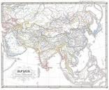
Keywords from Image Description:
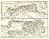
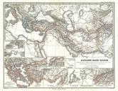
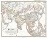
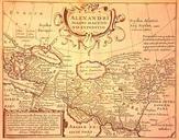
Spruneri Map of the Empire of Alexander the Great Geographicus RegnumAlexandrispruneri. This fascinating hand colored map depicts the Empire of Alexander the Great at its greatest extent Shows From Greece as far as east as modern day India and Pakistan and includes the entire Arabian peninsula Detailed insets depicts four of Alexander