Related Images


Download:
| Tiny | 76x128 | View | Download |
| Small | 153x256 | View | Download |
| Medium | 306x512 | View | Download |
| Large | 612x1024 | View | Download |
| Original | 2391x4000 | View | Download |
This image was acquired from
wikimedia. It was marked as Public Domain or CC0 and is free to use. To verify, go to the source and check the information there.
Looking for more info about this image?
Try a Google Reverse Image Search for it.
Try a Google Reverse Image Search for it.
Keywords from Image Description:
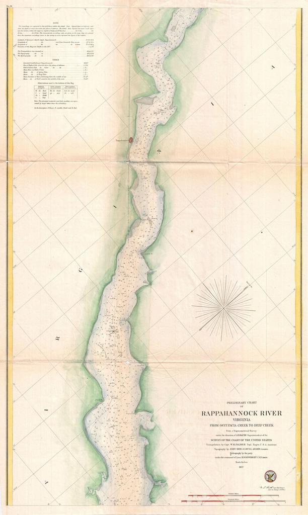
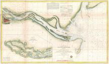
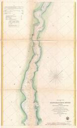
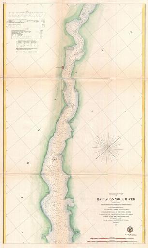
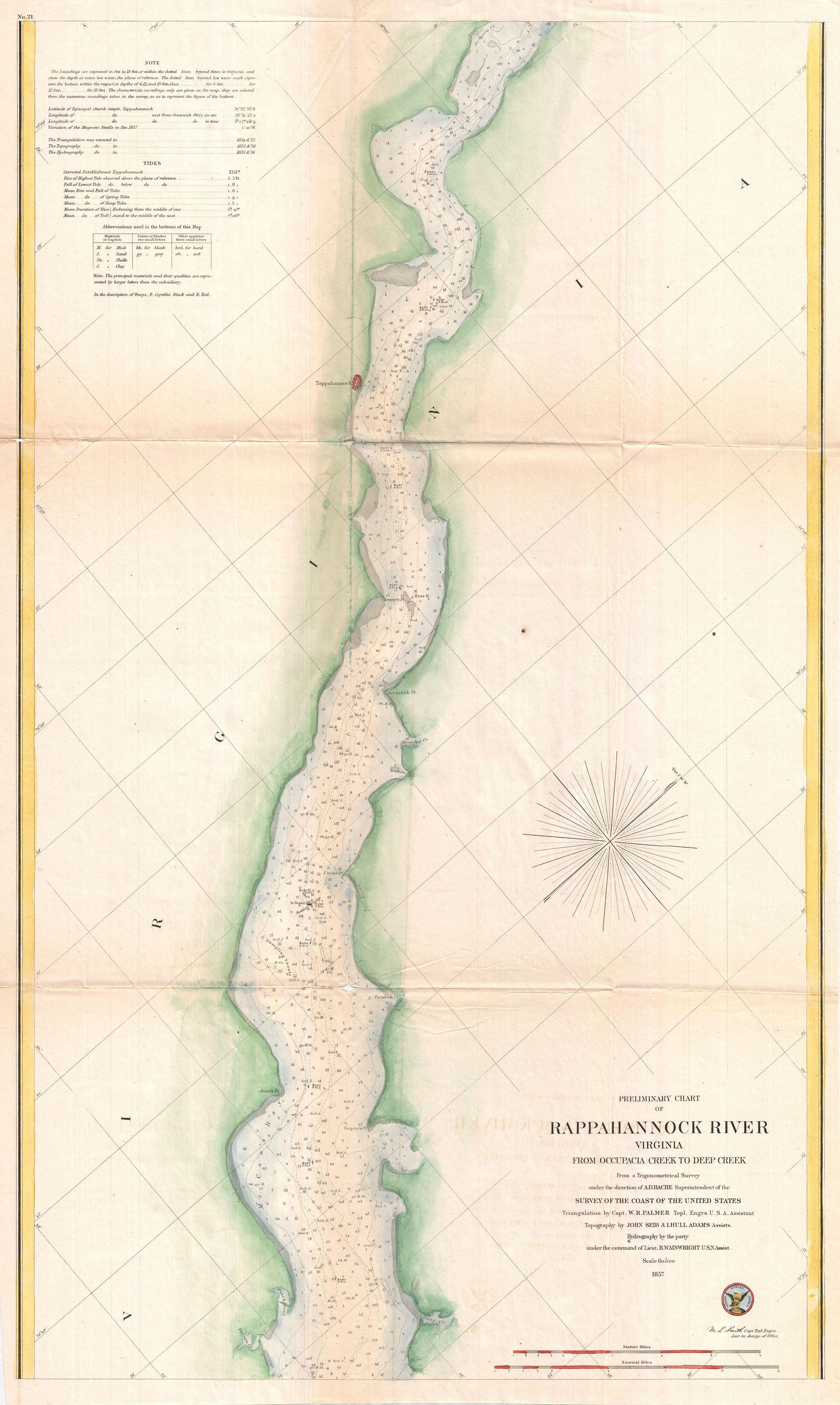
U.S. Coast Survey Map or Chart of the Rappahannock River Virginia Geographicus RappahannockRiveruscs. An attractive hand colored Coast Survey nautical chart or map of Virginia Rappahannock River Covers the course of the Rappahannock River from Occupacia Creek to Deep Creek Offers countless depth soundings and navigational notes