Related Images
Download:
| Tiny | 161x128 | View | Download |
| Small | 322x256 | View | Download |
| Medium | 645x512 | View | Download |
| Large | 1290x1024 | View | Download |
| Original | 3216x2551 | View | Download |
This image was acquired from
wikimedia. It was marked as Public Domain or CC0 and is free to use. To verify, go to the source and check the information there.
Looking for more info about this image?
Try a Google Reverse Image Search for it.
Try a Google Reverse Image Search for it.
Keywords from Image Description:
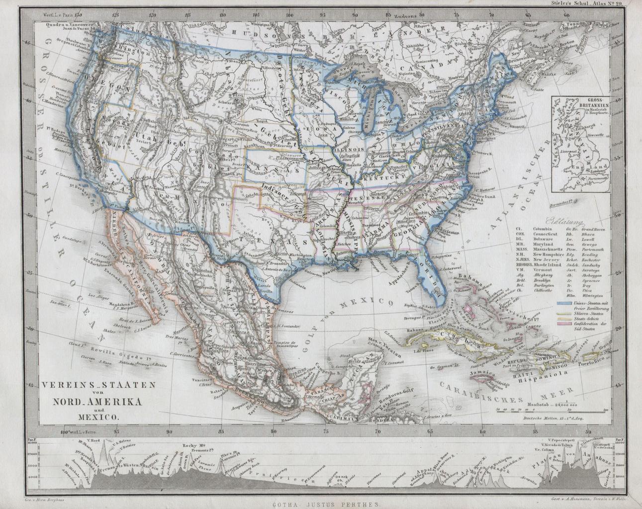
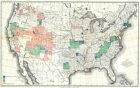
Stieler Map of the United States Geographicus USAperthes. This fascinating map by Justus Perthes and Stieler depicts the United States Mexico and the West Indies Made at the height of the Civil War this map separates the Union and Confederate States The Union is Blue as is the whole The Confederate states are pink Undeclared