Related Images

Download:
| Tiny | 93x128 | View | Download |
| Small | 186x256 | View | Download |
| Medium | 373x512 | View | Download |
| Large | 747x1024 | View | Download |
| Original | 2921x4000 | View | Download |
This image was acquired from
wikimedia. It was marked as Public Domain or CC0 and is free to use. To verify, go to the source and check the information there.
Looking for more info about this image?
Try a Google Reverse Image Search for it.
Try a Google Reverse Image Search for it.
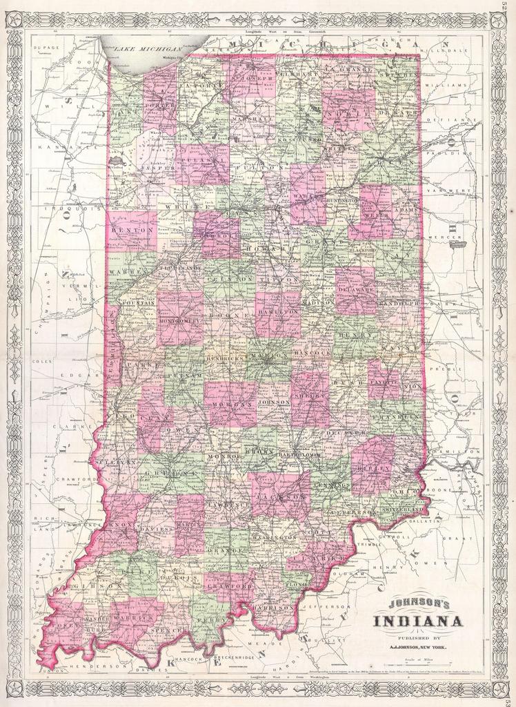
Keywords from Image Description:
Johnson Map of Indiana Geographicus INj. This is Johnson map of Indiana Covers the state divided into counties with special attention to transportation especially roads railroads and canals Features the Celtic style border common to Johnson atlas work from to Steel plate engraving prepared by Johnson for publication as plates