Related Images


Download:
| Tiny | 194x128 | View | Download |
| Small | 389x256 | View | Download |
| Medium | 779x512 | View | Download |
| Large | 1558x1024 | View | Download |
| Original | 4000x2629 | View | Download |
This image was acquired from
wikimedia. It was marked as Public Domain or CC0 and is free to use. To verify, go to the source and check the information there.
Looking for more info about this image?
Try a Google Reverse Image Search for it.
Try a Google Reverse Image Search for it.
Keywords from Image Description:
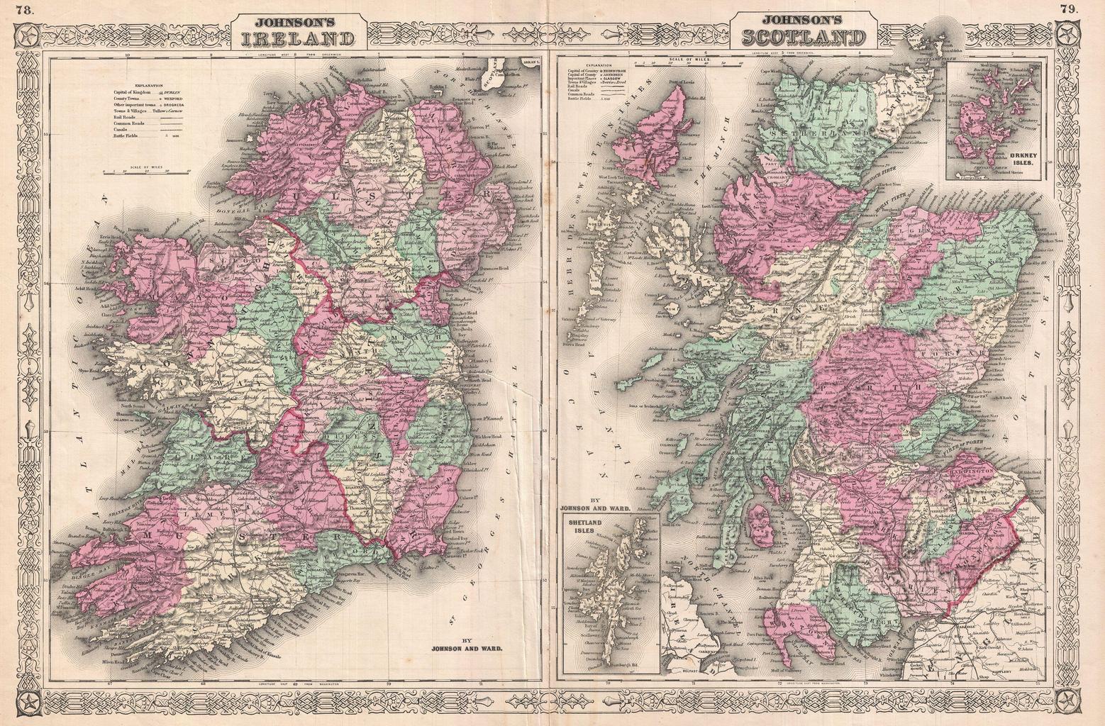
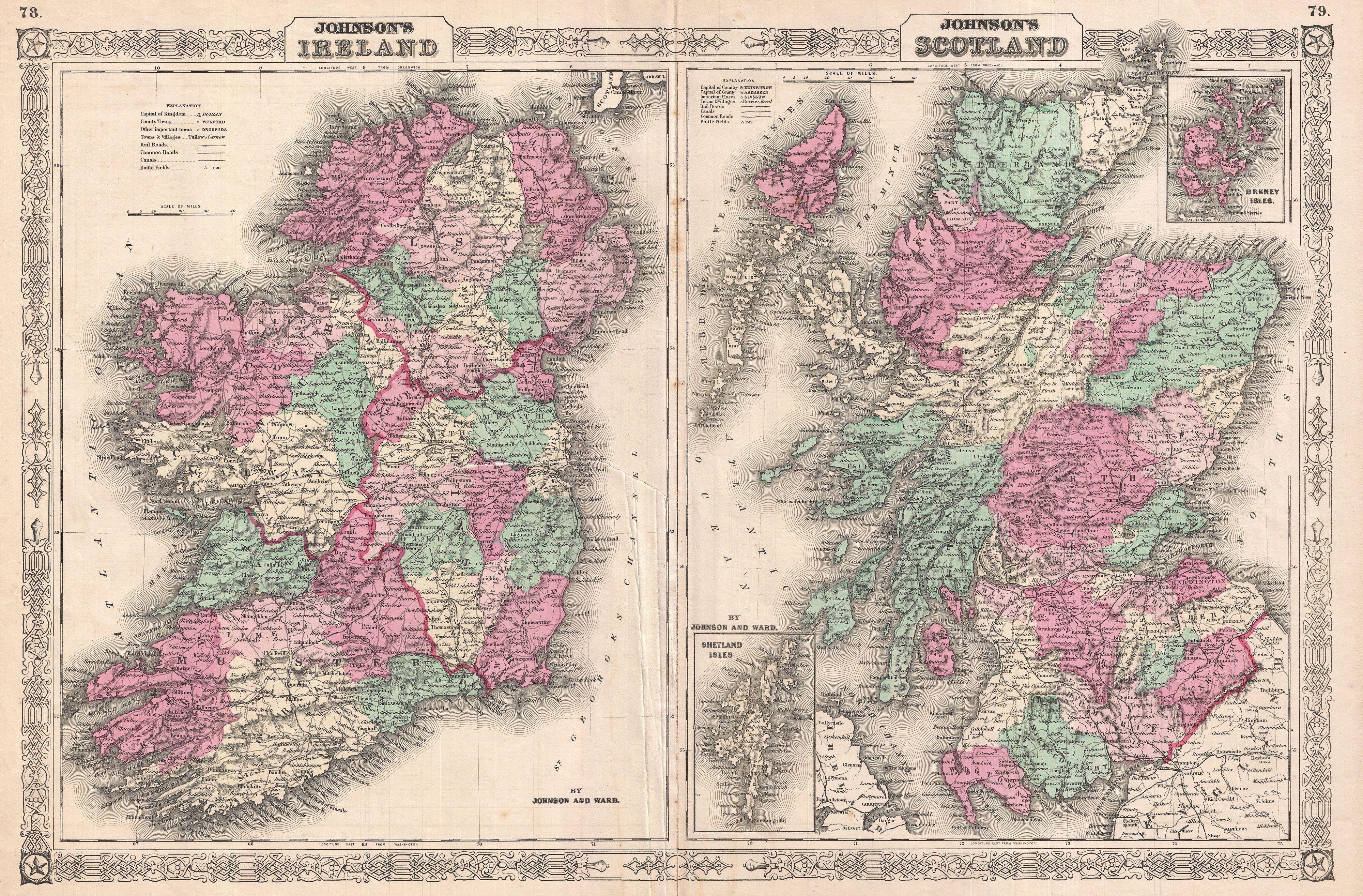
Johnson Map of Scotland and Ireland Geographicus ScotlandIrelandjohnson. This is Johnson and Ward map of Ireland and Scotland Essentially two maps on one sheet with the left hand map covering Ireland and the right hand map covering Scotland Both regions are divided into their constituent counties and districts with towns cities