Related Images


Download:
| Tiny | 82x128 | View | Download |
| Small | 165x256 | View | Download |
| Medium | 331x512 | View | Download |
| Large | 662x1024 | View | Download |
| Original | 3500x5411 | View | Download |
This image was acquired from
wikimedia. It was marked as Public Domain or CC0 and is free to use. To verify, go to the source and check the information there.
Looking for more info about this image?
Try a Google Reverse Image Search for it.
Try a Google Reverse Image Search for it.
Keywords from Image Description:
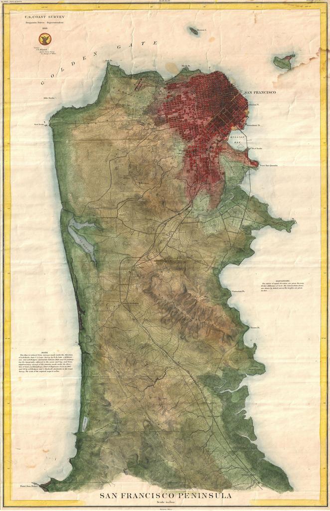
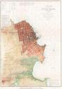
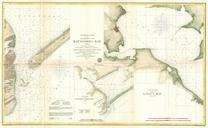
U.S. Coast Survey Map of the San Francisco Peninsula Geographicus SanFranciscoPeninsulauscs. rare Coast Survey chart or map of San Francisco Peninsula This map depicts the city of San Francisco and surrounding areas as far south as San Pedro and Millbrae Station The San Francisco San Jose Railroad the first to link the port