
Related Images


Download:
| Tiny | 186x128 | View | Download |
| Small | 372x256 | View | Download |
| Medium | 745x512 | View | Download |
| Large | 1491x1024 | View | Download |
| Original | 6000x4118 | View | Download |
This image was acquired from
wikimedia. It was marked as Public Domain or CC0 and is free to use. To verify, go to the source and check the information there.
Looking for more info about this image?
Try a Google Reverse Image Search for it.
Try a Google Reverse Image Search for it.
Keywords from Image Description:
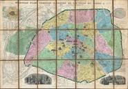
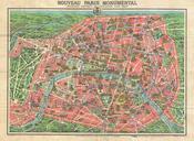
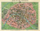
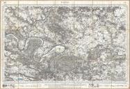
Depot de la Guerre Pocket Map of Paris and Environs Geographicus Parisdepotdeguerre. An exceptionally attractive military plan of Paris dating to Issued by the French mapping bureau the Depot de la Guerre this extremely detailed chart covers the vicinity of Paris from the Foret de Carnelle in the north to Versailles in the south