Download:
| Tiny | 95x128 | View | Download |
| Small | 191x256 | View | Download |
| Medium | 383x512 | View | Download |
| Large | 766x1024 | View | Download |
| Original tiff | 4712x6299 | View | Download |
| Original as jpg | 4712x6299 | View | Download |
This image was acquired from
wikimedia. It was marked as Public Domain or CC0 and is free to use. To verify, go to the source and check the information there.
Looking for more info about this image?
Try a Google Reverse Image Search for it.
Try a Google Reverse Image Search for it.
Keywords from Image Description:
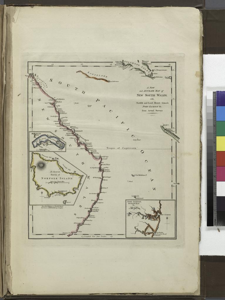
A new and accurate map of New South Wales with Norfolk and Lord Howes Islands Port Jackson etc from actual surveys. NYPL. atlas leaves of plates some folded hand col maps cm Carey Mathew Publisher Gridley Enoch Engraver Map Div updated nypl org cfm imageID nypl org Atlases gazetteers guidebooks and other books Carey's
