
Related Images


Download:
| Tiny | 80x128 | View | Download |
| Small | 161x256 | View | Download |
| Medium | 322x512 | View | Download |
| Large | 645x1024 | View | Download |
| Original | 1302x2065 | View | Download |
This image was acquired from
wikimedia. It was marked as Public Domain or CC0 and is free to use. To verify, go to the source and check the information there.
Looking for more info about this image?
Try a Google Reverse Image Search for it.
Try a Google Reverse Image Search for it.
Keywords from Image Description:
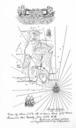
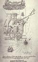
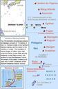
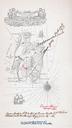
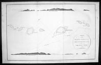
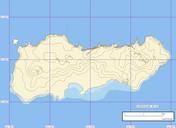
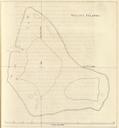
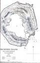
DeceptionIslandMap. en Map created on the first scientific expedition to Deception Island in under the command of captain Henry Foster Lieut Kendall PDold Maps of Deception Island Old maps of Antarctica