Related Images


Download:
| Tiny | 133x128 | View | Download |
| Small | 266x256 | View | Download |
| Original svg | 520x500 | View | Download |
| Original as jpg | 520x500 | View | Download |
This image was acquired from
wikimedia. It was marked as Public Domain or CC0 and is free to use. To verify, go to the source and check the information there.
Looking for more info about this image?
Try a Google Reverse Image Search for it.
Try a Google Reverse Image Search for it.
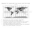
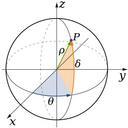
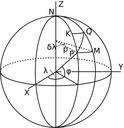
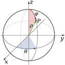
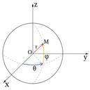
Keywords from Image Description:
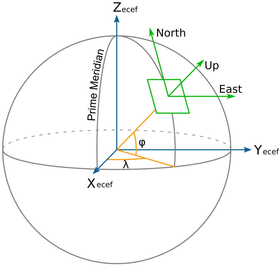
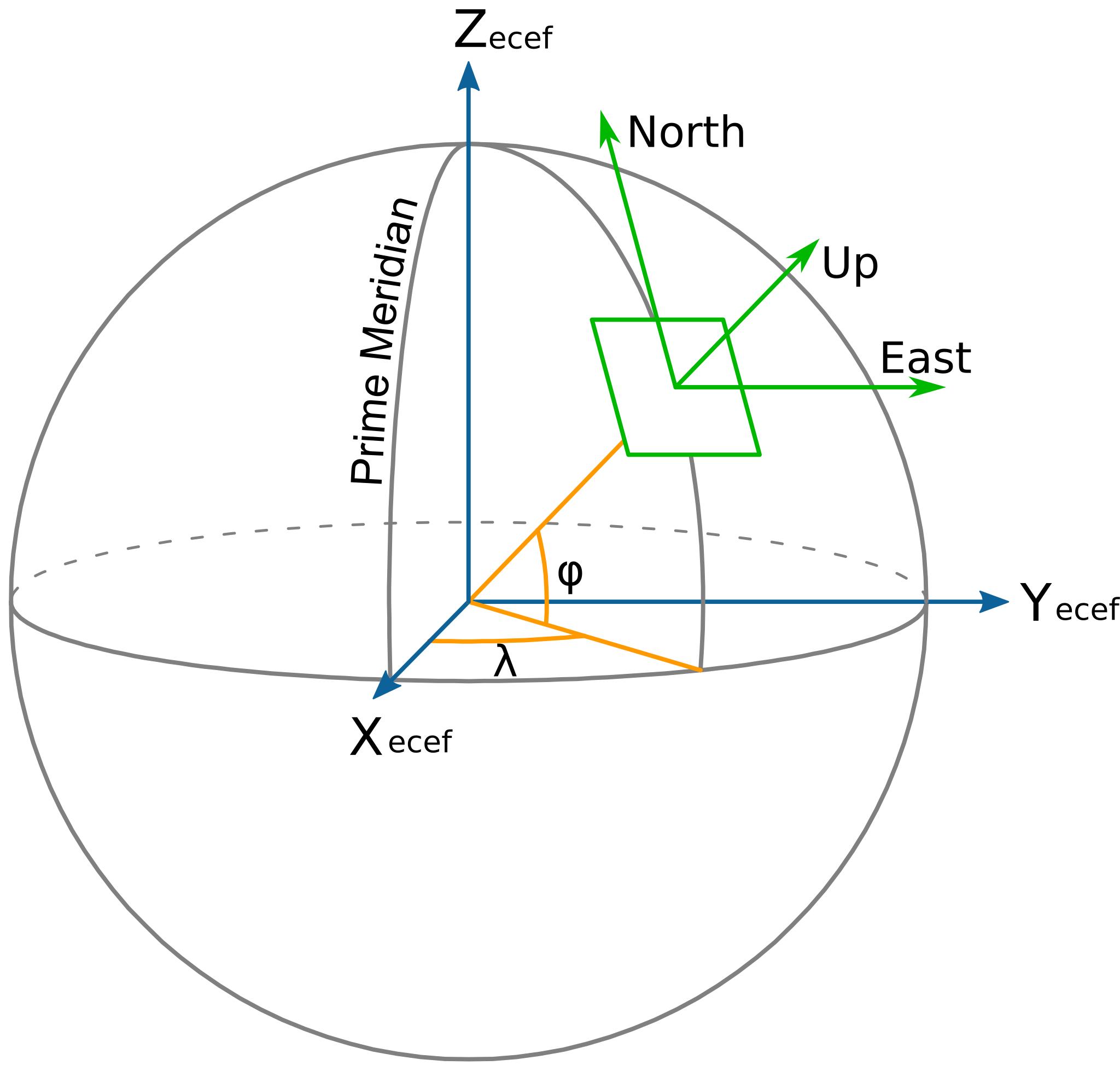
ECEF ENU Longitude Latitude relationships.svg diagram showing ECEF ENU Longitude and Latitude coordinates and the relationship between them Based on en File EarthTangentialPlane by en User Raffyl public domain Mike en File EarthTangentialPlane Cartesian coordinates space Spherical coordinates SVG diagrams SVG diagrams in English