
Related Images


Download:
| Tiny | 117x128 | View | Download |
| Small | 235x256 | View | Download |
| Medium | 471x512 | View | Download |
| Original | 477x518 | View | Download |
This image was acquired from
wikimedia. It was marked as Public Domain or CC0 and is free to use. To verify, go to the source and check the information there.
Looking for more info about this image?
Try a Google Reverse Image Search for it.
Try a Google Reverse Image Search for it.
Keywords from Image Description:
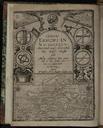
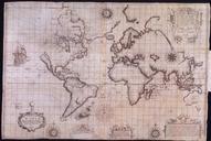
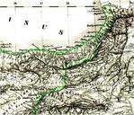
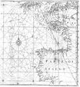
EdwardWrightMapforSailingtoAzores. English mathematician and cartographer Edward Wright's map for sailing to the Isles of Azores which was constructed according to the Mercator projection which Wright explained in his work Certaine Errors of Navigation The starlike grid of lines are loxodromes or rhumb lines cite book Edward Wright