
Related Images
Download:
| Tiny | 74x128 | View | Download |
| Small | 149x256 | View | Download |
| Medium | 299x512 | View | Download |
| Large | 599x1024 | View | Download |
| Original | 623x1065 | View | Download |
This image was acquired from
wikimedia. It was marked as Public Domain or CC0 and is free to use. To verify, go to the source and check the information there.
Looking for more info about this image?
Try a Google Reverse Image Search for it.
Try a Google Reverse Image Search for it.
Keywords from Image Description:
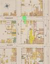
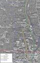
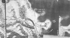
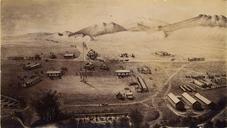
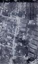
Glenville shootout aerial map. en Aerial photograph of the area in the Glenville neighborhood of Cleveland Ohio where the Glenville shootout occurred on July ebrary action docID Masotti Louis Corsi Jerome ShootOut in Cleveland Black Militants and the Police Report to the National Commission on the Causes and Prevention of Violence