Related Images


Download:
| Tiny | 404x128 | View | Download |
| Original png | 800x253 | View | Download |
| Original as jpg | 800x253 | View | Download |
This image was acquired from
wikimedia. It was marked as Public Domain or CC0 and is free to use. To verify, go to the source and check the information there.
Looking for more info about this image?
Try a Google Reverse Image Search for it.
Try a Google Reverse Image Search for it.
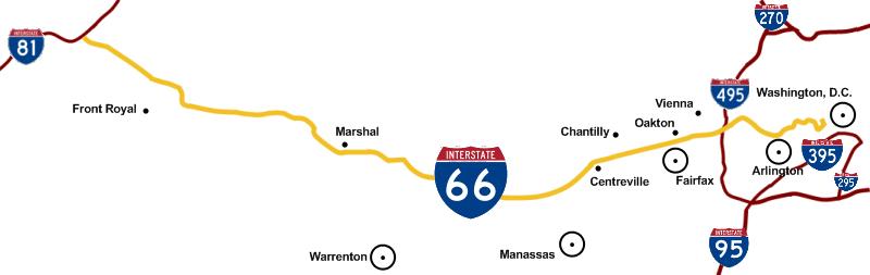
Keywords from Image Description:
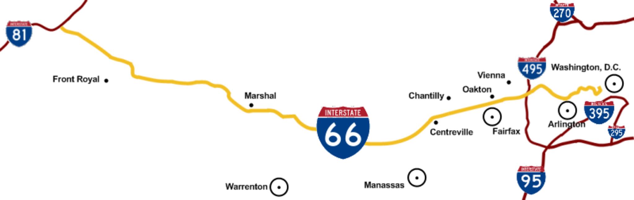
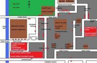
Itoscale. en To scale map of Interstate showing DC area interstates and cities along the Interstate corridor Own Squiggyfm grant anyone the right to use this work for any purpose without any conditions unless such conditions are required by law Interstate Road maps of Interstate Highways Road maps of Virginia