
Related Images


Download:
| Tiny | 129x128 | View | Download |
| Small | 258x256 | View | Download |
| Medium | 516x512 | View | Download |
| Large | 1033x1024 | View | Download |
| Original | 1257x1245 | View | Download |
This image was acquired from
wikimedia. It was marked as Public Domain or CC0 and is free to use. To verify, go to the source and check the information there.
Looking for more info about this image?
Try a Google Reverse Image Search for it.
Try a Google Reverse Image Search for it.
Keywords from Image Description:
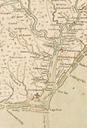
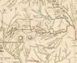
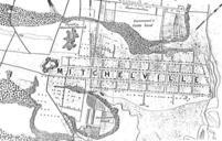
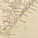
Collet Map excerpt showing Wilmington and Brunswick. An excerpt of John Collet's map of North Carolina depicting several plantations and settlements on the lower Cape Fear River including Wilmington Brunswick and the plantation of Colonel Howe Original publication Londonbr Immediate source University of North Carolina Digital Collections