Related Images


Download:
| Tiny | 101x128 | View | Download |
| Small | 202x256 | View | Download |
| Medium | 404x512 | View | Download |
| Large | 808x1024 | View | Download |
| Original png | 2396x3033 | View | Download |
| Original as jpg | 2396x3033 | View | Download |
This image was acquired from
wikimedia. It was marked as Public Domain or CC0 and is free to use. To verify, go to the source and check the information there.
Looking for more info about this image?
Try a Google Reverse Image Search for it.
Try a Google Reverse Image Search for it.
Keywords from Image Description:
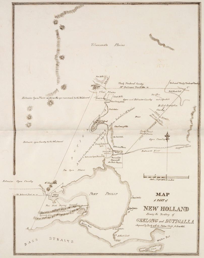
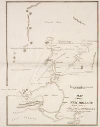
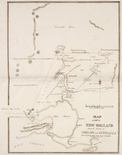
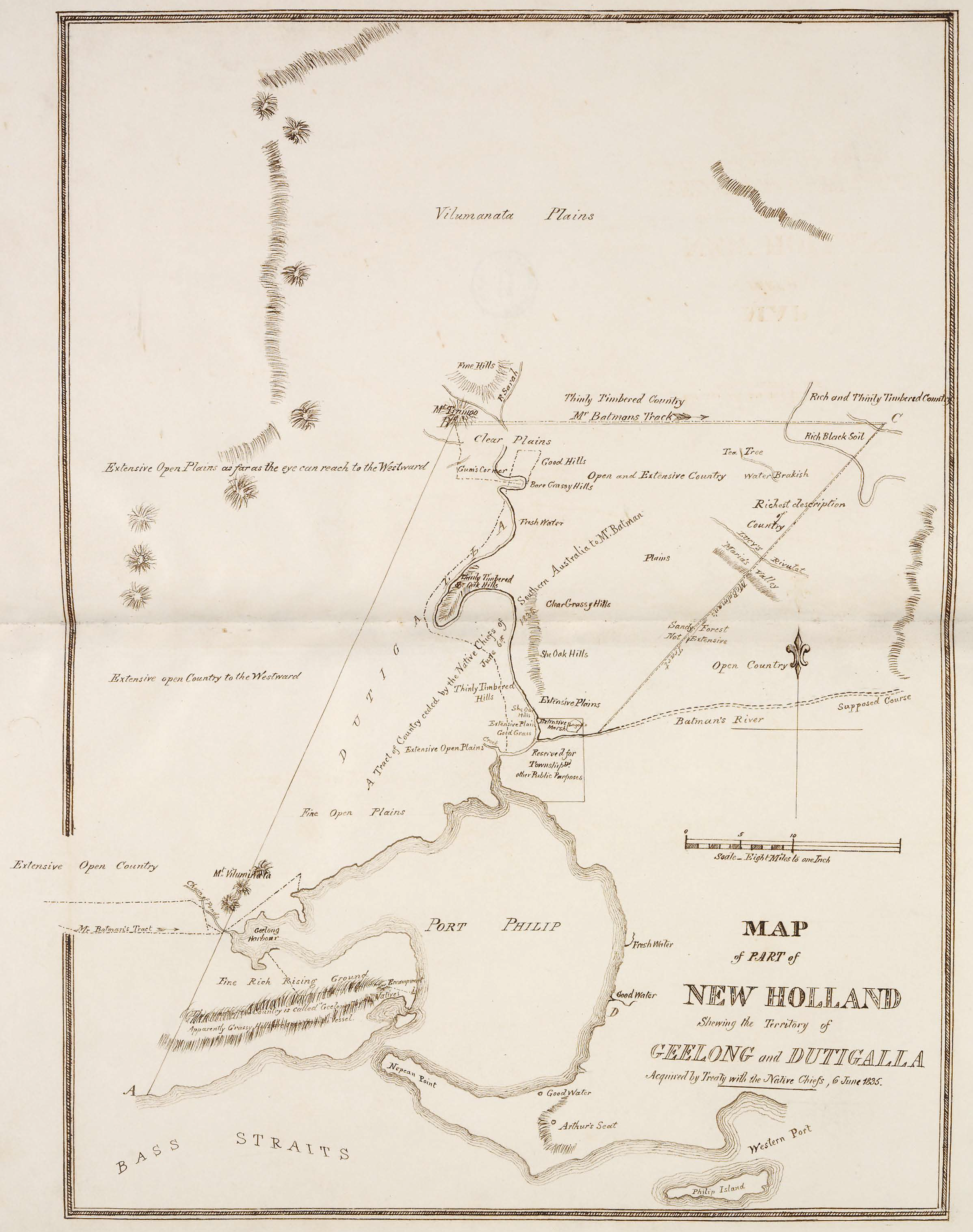
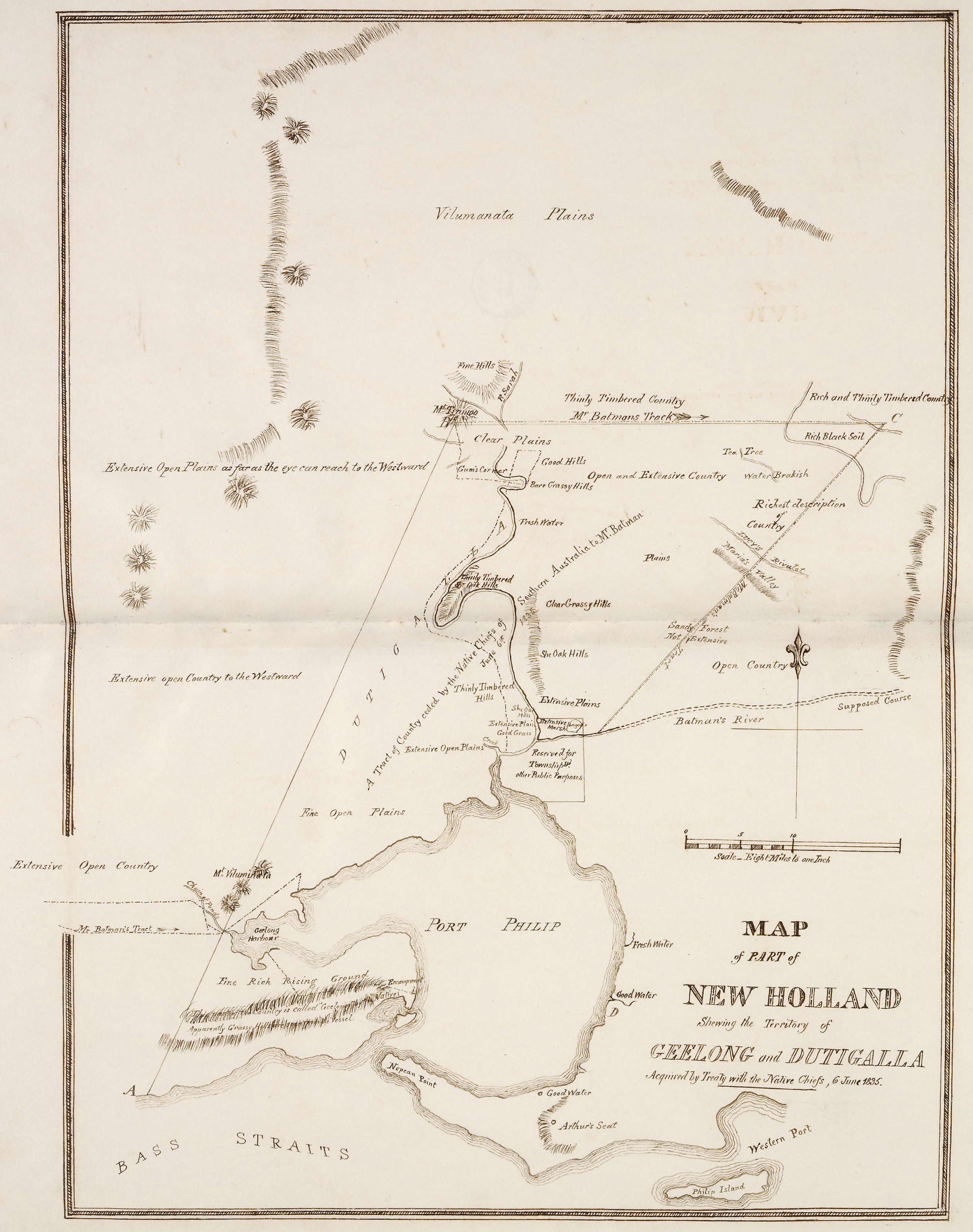
Map of part of New Holland showing the territory of Geelong and Dutigalla. en This is map of the area which is now Melbourne and the Port Philip Bay in Australia including the northerly Hinterland The original map caption reads MAP of PART of NEW HOLLAND Showing the Territory of GEELONG and DUTIGALLA Acquired by Treaty with the Native