
Related Images


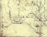


Download:
| Tiny | 248x128 | View | Download |
| Small | 497x256 | View | Download |
| Medium | 994x512 | View | Download |
| Original png | 1392x717 | View | Download |
| Original as jpg | 1392x717 | View | Download |
This image was acquired from
wikimedia. It was marked as Public Domain or CC0 and is free to use. To verify, go to the source and check the information there.
Looking for more info about this image?
Try a Google Reverse Image Search for it.
Try a Google Reverse Image Search for it.
Keywords from Image Description:
Map detail of Laar in the county of Bentheim . en topographic map for the Dutch military dutch Topografische militaire kaart Bonneblad zwart created between between map number between nl Dutch military added information in German about the locations of the local manors Gut the reformed church and crossed out the false