
Related Images


Download:
| Tiny | 167x128 | View | Download |
| Small | 334x256 | View | Download |
| Original png | 434x332 | View | Download |
| Original as jpg | 434x332 | View | Download |
This image was acquired from
wikimedia. It was marked as Public Domain or CC0 and is free to use. To verify, go to the source and check the information there.
Looking for more info about this image?
Try a Google Reverse Image Search for it.
Try a Google Reverse Image Search for it.
Keywords from Image Description:
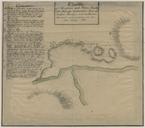
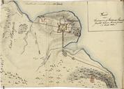
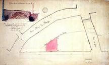
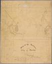
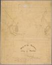
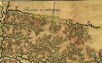
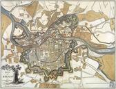
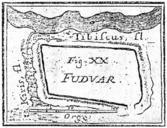
Map of earthen fortification Cnesa drawn by Marsigli. en Drawing of an earthen fortification discovered and measured up by count Luigi Ferdinando Marsigli in It is situated in northern Serbia by the Tisza river He called it Fudvar from Fldvr the Hungarian equivalent of the word en Kanizsa Magyarkanizsa Vajdasg Szerbia helyn grf