Related Images

Download:
| Tiny | 140x128 | View | Download |
| Small | 280x256 | View | Download |
| Medium | 560x512 | View | Download |
| Large | 1120x1024 | View | Download |
| Original | 7000x6395 | View | Download |
This image was acquired from
wikimedia. It was marked as Public Domain or CC0 and is free to use. To verify, go to the source and check the information there.
Looking for more info about this image?
Try a Google Reverse Image Search for it.
Try a Google Reverse Image Search for it.
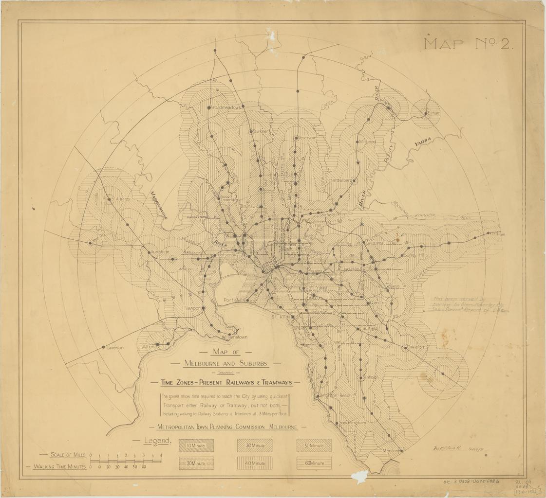
Keywords from Image Description:
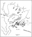
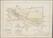
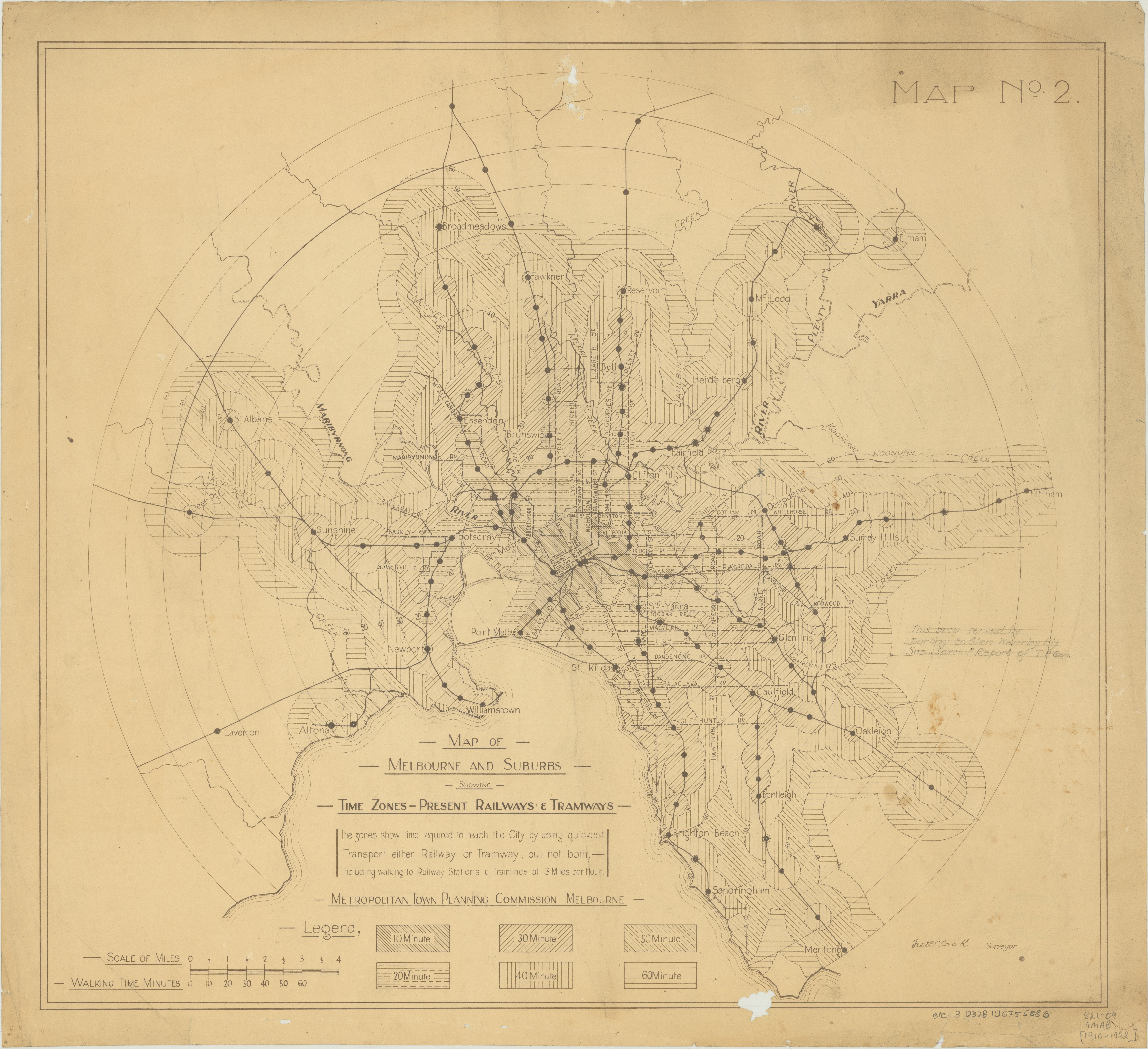
Map of Melbourne and suburbs showing time zonespresent railways tramways. Isochrone map of Melbourne travel times to the city centre by rail monochrome Map note reads The zones show time required to reach the city by using quickest transport either railway or tramway but not both Including walking to railway station tramlines at