
Related Images


Download:
| Tiny | 297x128 | View | Download |
| Small | 594x256 | View | Download |
| Medium | 1189x512 | View | Download |
| Large | 2378x1024 | View | Download |
| Original png | 2975x1281 | View | Download |
| Original as jpg | 2975x1281 | View | Download |
This image was acquired from
wikimedia. It was marked as Public Domain or CC0 and is free to use. To verify, go to the source and check the information there.
Looking for more info about this image?
Try a Google Reverse Image Search for it.
Try a Google Reverse Image Search for it.
Keywords from Image Description:
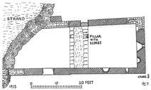
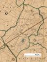
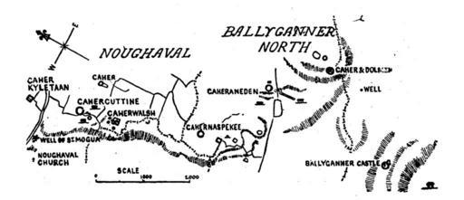
Map Noughaval and Ballyganner North by Thomas Johnson Westropp . Map of ancient sites in the townlands of Noughaval and Ballyganner North drawn by Thomas Johnson Westropp in Fig on of Thomas Westropp The Journal of the Royal Society of Antiquaries of Ireland Fifth Series Vol No Jun pp Thomas Johnson Westropp PDoldauto