
Related Images


Download:
| Tiny | 158x128 | View | Download |
| Small | 316x256 | View | Download |
| Medium | 632x512 | View | Download |
| Large | 1264x1024 | View | Download |
| Original | 4000x3238 | View | Download |
This image was acquired from
wikimedia. It was marked as Public Domain or CC0 and is free to use. To verify, go to the source and check the information there.
Looking for more info about this image?
Try a Google Reverse Image Search for it.
Try a Google Reverse Image Search for it.
Keywords from Image Description:
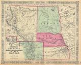
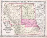
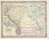
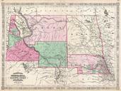
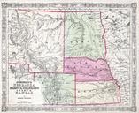
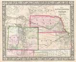
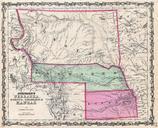
Johnson Map of Kansas Nebraska and Dakota Geographicus NEKADKjohnson. From the Johnson and Ward edition of the Atlas this is one of the rarest and most desirable states of the Johnson Dakota Nebraska and Kansas map In this example Nebraska is drawn with long panhandle extending from Iowa all the way to Fremont Peak To the north