
Related Images


Download:
| Tiny | 170x128 | View | Download |
| Small | 340x256 | View | Download |
| Medium | 681x512 | View | Download |
| Large | 1362x1024 | View | Download |
| Original tiff | 10328x7760 | View | Download |
| Original as jpg | 10328x7760 | View | Download |
This image was acquired from
wikimedia. It was marked as Public Domain or CC0 and is free to use. To verify, go to the source and check the information there.
Looking for more info about this image?
Try a Google Reverse Image Search for it.
Try a Google Reverse Image Search for it.
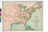
Keywords from Image Description:
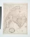
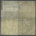
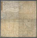
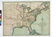
Map of the western and middle portions of North America NYPL b. en Relief shown by hachures Shows Sandwich Islands Russian America and western portion of British America Mexico and the United States Longitude west from Washington along bottom margin Longitude west from Greenwich along top margin Scale approximately Mapping the