Download:
| Tiny | 128x128 | View | Download |
| Small | 256x256 | View | Download |
| Medium | 512x512 | View | Download |
| Large | 1024x1024 | View | Download |
| Original | 1536x1536 | View | Download |
This image was acquired from
wikimedia. It was marked as Public Domain or CC0 and is free to use. To verify, go to the source and check the information there.
Looking for more info about this image?
Try a Google Reverse Image Search for it.
Try a Google Reverse Image Search for it.
Keywords from Image Description:
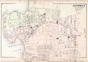
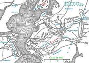
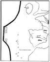
MapNewtownLargeDetailNYPLfromRiker. en This is detail from Map of Newtown Long Island Designed to exhibit the localities referred to in the 'Annals of Newtown ' Compiled by Riker Jr It shows the area that would become Woodside bounded in the west by Middletown and Dutch Kills shown as Kills in the detail in the south by English


