Related Images

Download:
| Tiny | 95x128 | View | Download |
| Small | 191x256 | View | Download |
| Medium | 383x512 | View | Download |
| Large | 766x1024 | View | Download |
| Original | 1497x2000 | View | Download |
This image was acquired from
wikimedia. It was marked as Public Domain or CC0 and is free to use. To verify, go to the source and check the information there.
Looking for more info about this image?
Try a Google Reverse Image Search for it.
Try a Google Reverse Image Search for it.
Keywords from Image Description:
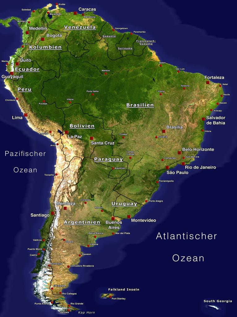
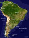
South America Satellite Orthographic Political Map. en Political Map of South America with the largest Cities based on the Visible Earth Satellite Image by NASA nasa gov php vevid de Politische Karte von Sdamerika mit den grten Stdten Basierend auf dem Satellitenbild von Visible Earth NASA nasa gov php vevid own Oliver Gnther