
Related Images


Download:
| Tiny | 98x128 | View | Download |
| Small | 196x256 | View | Download |
| Medium | 392x512 | View | Download |
| Large | 785x1024 | View | Download |
| Original | 3070x4000 | View | Download |
This image was acquired from
wikimedia. It was marked as Public Domain or CC0 and is free to use. To verify, go to the source and check the information there.
Looking for more info about this image?
Try a Google Reverse Image Search for it.
Try a Google Reverse Image Search for it.
Keywords from Image Description:
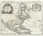
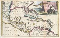
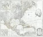
Hennepin First Book and Map of North America first printed map to name Louisiana Geographicus NieuwVrankrykhennepin. Artwork de la Louisiane of which this is the first Dutch edition This book features map that depicts much of the upper Mississippi valley but does not suggest exploration as far as the Gulf of Mexico as do Hennepin