Related Images


Download:
| Tiny | 206x128 | View | Download |
| Small | 413x256 | View | Download |
| Medium | 827x512 | View | Download |
| Large | 1655x1024 | View | Download |
| Original | 4000x2474 | View | Download |
This image was acquired from
wikimedia. It was marked as Public Domain or CC0 and is free to use. To verify, go to the source and check the information there.
Looking for more info about this image?
Try a Google Reverse Image Search for it.
Try a Google Reverse Image Search for it.
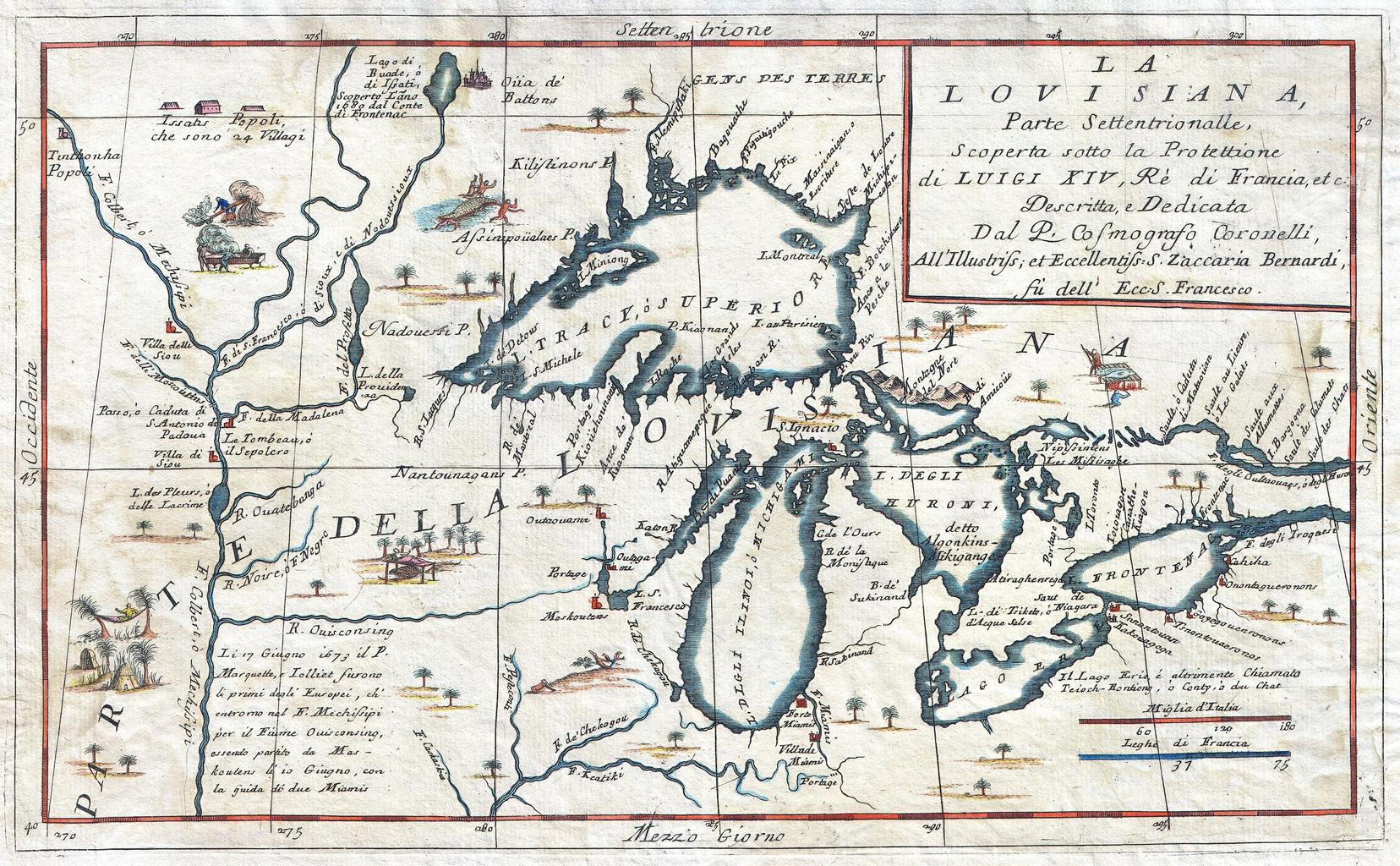
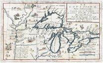
Keywords from Image Description:
Coronelli Map of the Great Lakes Most Accurate Map of the Great Lakes in the th Century Geographicus LaLouisianacoronelli. This exceedingly rare map by Vincenzo Coronelli is the most important depiction of the Great Lakes and the headwaters of the Mississippi River to appear in the late th century Covers all five Great Lakes