Related Images


Download:
| Tiny | 159x128 | View | Download |
| Small | 318x256 | View | Download |
| Medium | 637x512 | View | Download |
| Large | 1274x1024 | View | Download |
| Original | 4000x3215 | View | Download |
This image was acquired from
wikimedia. It was marked as Public Domain or CC0 and is free to use. To verify, go to the source and check the information there.
Looking for more info about this image?
Try a Google Reverse Image Search for it.
Try a Google Reverse Image Search for it.
Keywords from Image Description:
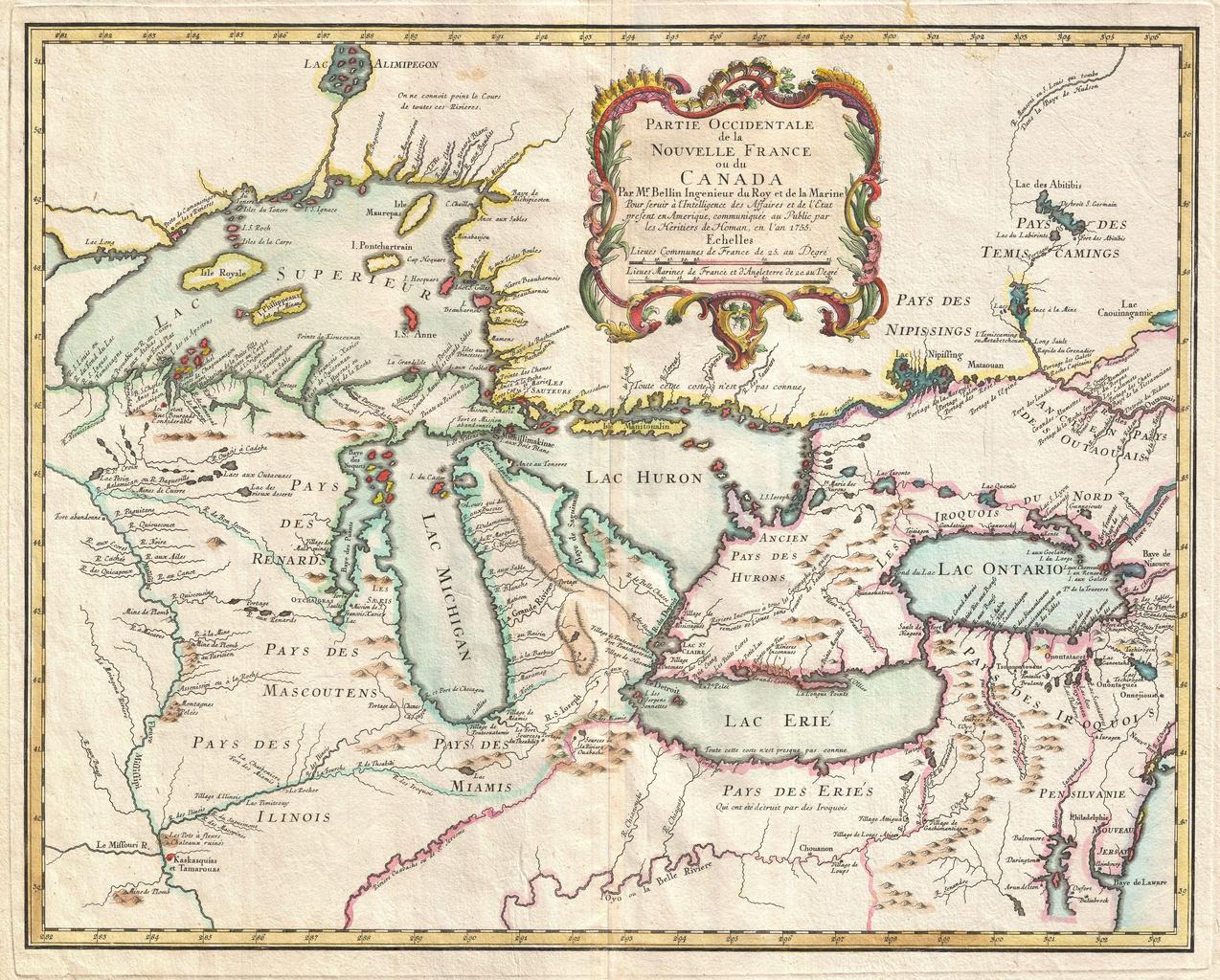
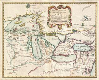
Bellin Map of the Great Lakes Geographicus GreatLakesbellin. rare and extremely influential map of the Great Lakes drawn by Jacques Nicholas Bellin This map which appeared in the issue of the Homann Heirs Atlas Major covers all five of the Great Lakes as well as the adjacent Indian lands and the English colonies of Pennsylvania