
Related Images


Download:
| Tiny | 182x128 | View | Download |
| Small | 364x256 | View | Download |
| Medium | 729x512 | View | Download |
| Large | 1458x1024 | View | Download |
| Original | 2500x1755 | View | Download |
This image was acquired from
wikimedia. It was marked as Public Domain or CC0 and is free to use. To verify, go to the source and check the information there.
Looking for more info about this image?
Try a Google Reverse Image Search for it.
Try a Google Reverse Image Search for it.
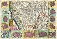
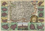
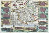
Keywords from Image Description:
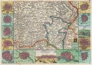
La Feuille Map of Brabant vicinity of Brussels Belgium Geographicus Hertogdomlafeuille. stunning map of Brabant Belgium first drawn by Daniel de la Feuille in Depicts from Brussels in the south west eastward as far as Limburg and Roermont Surrounded by thirteen maps and views of important villages and fortresses in this region