
Related Images


Download:
| Tiny | 179x128 | View | Download |
| Small | 358x256 | View | Download |
| Medium | 717x512 | View | Download |
| Large | 1435x1024 | View | Download |
| Original | 2500x1783 | View | Download |
This image was acquired from
wikimedia. It was marked as Public Domain or CC0 and is free to use. To verify, go to the source and check the information there.
Looking for more info about this image?
Try a Google Reverse Image Search for it.
Try a Google Reverse Image Search for it.
Keywords from Image Description:
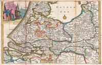
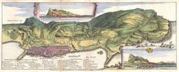
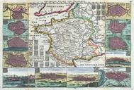
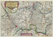
La Feuille Map of Liege Belgium Leodiensis Geographicus Leodiensislafeuille. stunning map of Leodiensis or the vicinity of Liege Belgium first drawn by Daniel de la Feuille in Depicts from Hoey in the west eastward as far as Peer southward as far as Dalem and northwards as far as Tienen Latin title cartouche in the upper left