
Related Images

Download:
| Tiny | 190x128 | View | Download |
| Small | 381x256 | View | Download |
| Medium | 763x512 | View | Download |
| Large | 1527x1024 | View | Download |
| Original | 3212x2153 | View | Download |
This image was acquired from
wikimedia. It was marked as Public Domain or CC0 and is free to use. To verify, go to the source and check the information there.
Looking for more info about this image?
Try a Google Reverse Image Search for it.
Try a Google Reverse Image Search for it.
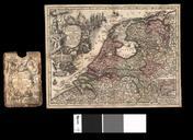
Keywords from Image Description:
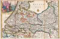
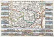
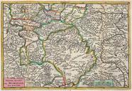
De La Feuille Map of the Netherlands Belgium and Luxembourg Geographicus Provinceslaveuille. very scarce map of Belgium the Netherlands and Luxembourg by Daniel de la Feuille The main map is surrounded by seventeen plans and views of major cities in the region Namur Bruxelles Brussels Arras Campen Limbourg Gueldre Groningue Anvers