
Related Images


Download:
| Tiny | 263x128 | View | Download |
| Small | 526x256 | View | Download |
| Medium | 1053x512 | View | Download |
| Large | 2106x1024 | View | Download |
| Original | 5000x2430 | View | Download |
This image was acquired from
wikimedia. It was marked as Public Domain or CC0 and is free to use. To verify, go to the source and check the information there.
Looking for more info about this image?
Try a Google Reverse Image Search for it.
Try a Google Reverse Image Search for it.
Keywords from Image Description:
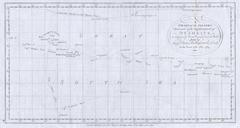
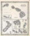
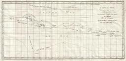
Cook Map of Tahiti the Society Islands and the Vicinity Geographicus OtahitiDecouvertscook. This is fine map shows the explorations of Captain Cook Captain Byron Captain Wallis and Captain Carteret in the vicinity of Tahiti and the Society Islands from to Extends from Is Scilly the Scilly Islands in the west and to Whitsunday