Related Images
Download:
| Tiny | 194x128 | View | Download |
| Small | 389x256 | View | Download |
| Medium | 779x512 | View | Download |
| Large | 1559x1024 | View | Download |
| Original | 3000x1970 | View | Download |
This image was acquired from
wikimedia. It was marked as Public Domain or CC0 and is free to use. To verify, go to the source and check the information there.
Looking for more info about this image?
Try a Google Reverse Image Search for it.
Try a Google Reverse Image Search for it.
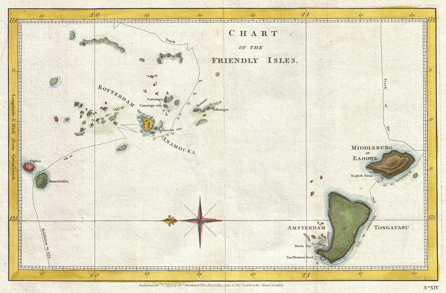
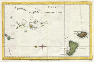
Keywords from Image Description:
Cook Map of the Friendly Islands or Tonga Geographicus FriendlyIslescook. highly uncommon chart of the Friendly Islands or Tonga from Oriented to the East this map depicts the Tongatapu Island Group and the Ha'Apai Group that make up the Kingdom of Tonga Shows the routes of the Resolution and the Adventure on Captain Cook's second