
Related Images


Download:
| Tiny | 160x128 | View | Download |
| Small | 320x256 | View | Download |
| Medium | 641x512 | View | Download |
| Large | 1283x1024 | View | Download |
| Original | 5000x3990 | View | Download |
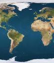
This image was acquired from
wikimedia. It was marked as Public Domain or CC0 and is free to use. To verify, go to the source and check the information there.
Looking for more info about this image?
Try a Google Reverse Image Search for it.
Try a Google Reverse Image Search for it.
Keywords from Image Description:
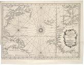
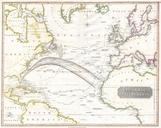
Thomson Map of the Atlantic Ocean Geographicus Atlantict. This fascinating hand colored map by Edinburgh cartographer John Thomson depicts the northern part of the Atlantic Ocean Extends as for north as Iceland and as far south as Brazil and the Congo Made during the Napoleonic wars this stunning map includes references to important