
Related Images


Download:
| Tiny | 156x128 | View | Download |
| Small | 312x256 | View | Download |
| Medium | 624x512 | View | Download |
| Large | 1249x1024 | View | Download |
| Original | 4000x3277 | View | Download |
This image was acquired from
wikimedia. It was marked as Public Domain or CC0 and is free to use. To verify, go to the source and check the information there.
Looking for more info about this image?
Try a Google Reverse Image Search for it.
Try a Google Reverse Image Search for it.
Keywords from Image Description:
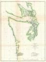
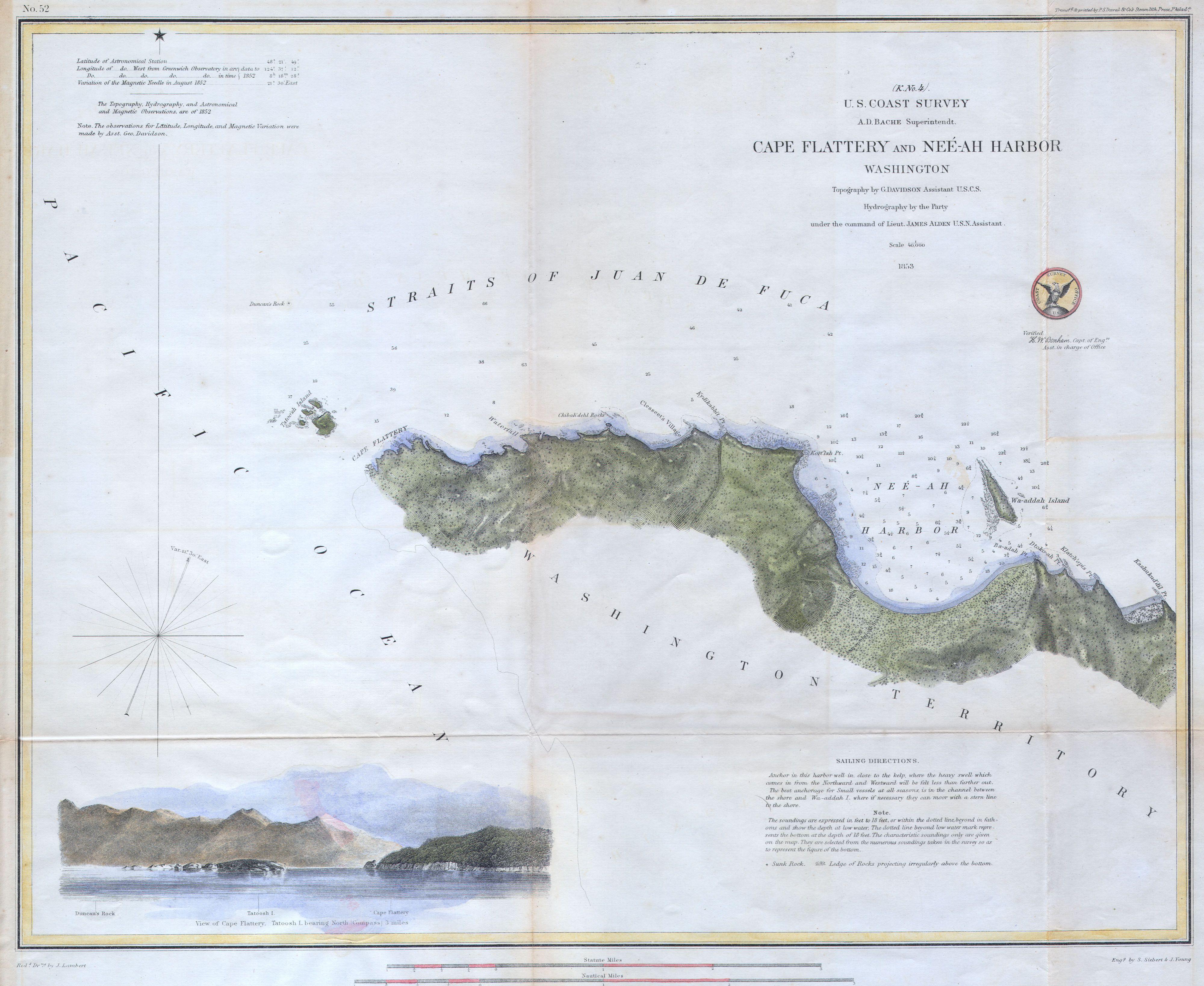
U.S.C.S. Chart or Map of Cape Flattery and NeeAH Harbor Washington Geographicus CapeFlatteryuscs. Offered is rare nautical chart of Cape Flattery and Neeah Harbor on the Juan de Fuca Straights Washington State Cape Flattery is the furthest northwest point in the contagious United States Here the Straits of Juan de Fuca empty into