
Related Images


Download:
| Tiny | 115x128 | View | Download |
| Small | 230x256 | View | Download |
| Medium | 460x512 | View | Download |
| Large | 920x1024 | View | Download |
| Original | 4500x5008 | View | Download |
This image was acquired from
wikimedia. It was marked as Public Domain or CC0 and is free to use. To verify, go to the source and check the information there.
Looking for more info about this image?
Try a Google Reverse Image Search for it.
Try a Google Reverse Image Search for it.
Keywords from Image Description:
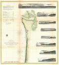
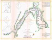
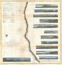
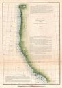
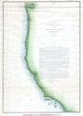
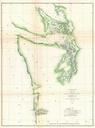
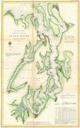
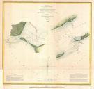
U.S. Coast Survey Chart or Map of Washington and Oregon Geographicus WashingonOregonuscs. One of the Coast Survey most attractive productions this is rare hand colored chart of the coastline of the Pacific Northwest including the modern day states of Washington and Oregon The map extends from the OregonCalifornia border northward


