
Related Images

Download:
| Tiny | 162x128 | View | Download |
| Small | 324x256 | View | Download |
| Medium | 648x512 | View | Download |
| Large | 1296x1024 | View | Download |
| Original | 3500x2764 | View | Download |
This image was acquired from
wikimedia. It was marked as Public Domain or CC0 and is free to use. To verify, go to the source and check the information there.
Looking for more info about this image?
Try a Google Reverse Image Search for it.
Try a Google Reverse Image Search for it.
Keywords from Image Description:
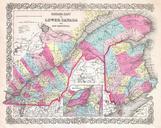
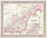
Colton Map of Quebec and New Brunswick Canada Geographicus CanadaEastcolton. This is the uncommon issue of Colton map of Quebec and New Brunswick At the time this region was referred to as Canada East or Lower Canada Covers lower Canada from Tadoussac in the North to the borders of Maine and Vermont in the south and from Huntingdon