Related Images


Download:
| Tiny | 100x128 | View | Download |
| Small | 200x256 | View | Download |
| Medium | 400x512 | View | Download |
| Large | 800x1024 | View | Download |
| Original | 4000x5118 | View | Download |
This image was acquired from
wikimedia. It was marked as Public Domain or CC0 and is free to use. To verify, go to the source and check the information there.
Looking for more info about this image?
Try a Google Reverse Image Search for it.
Try a Google Reverse Image Search for it.
Keywords from Image Description:
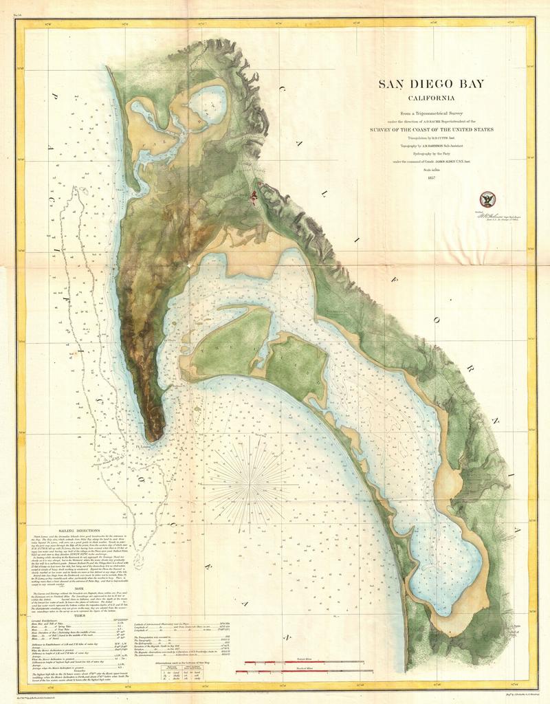
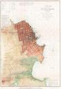
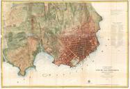
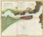
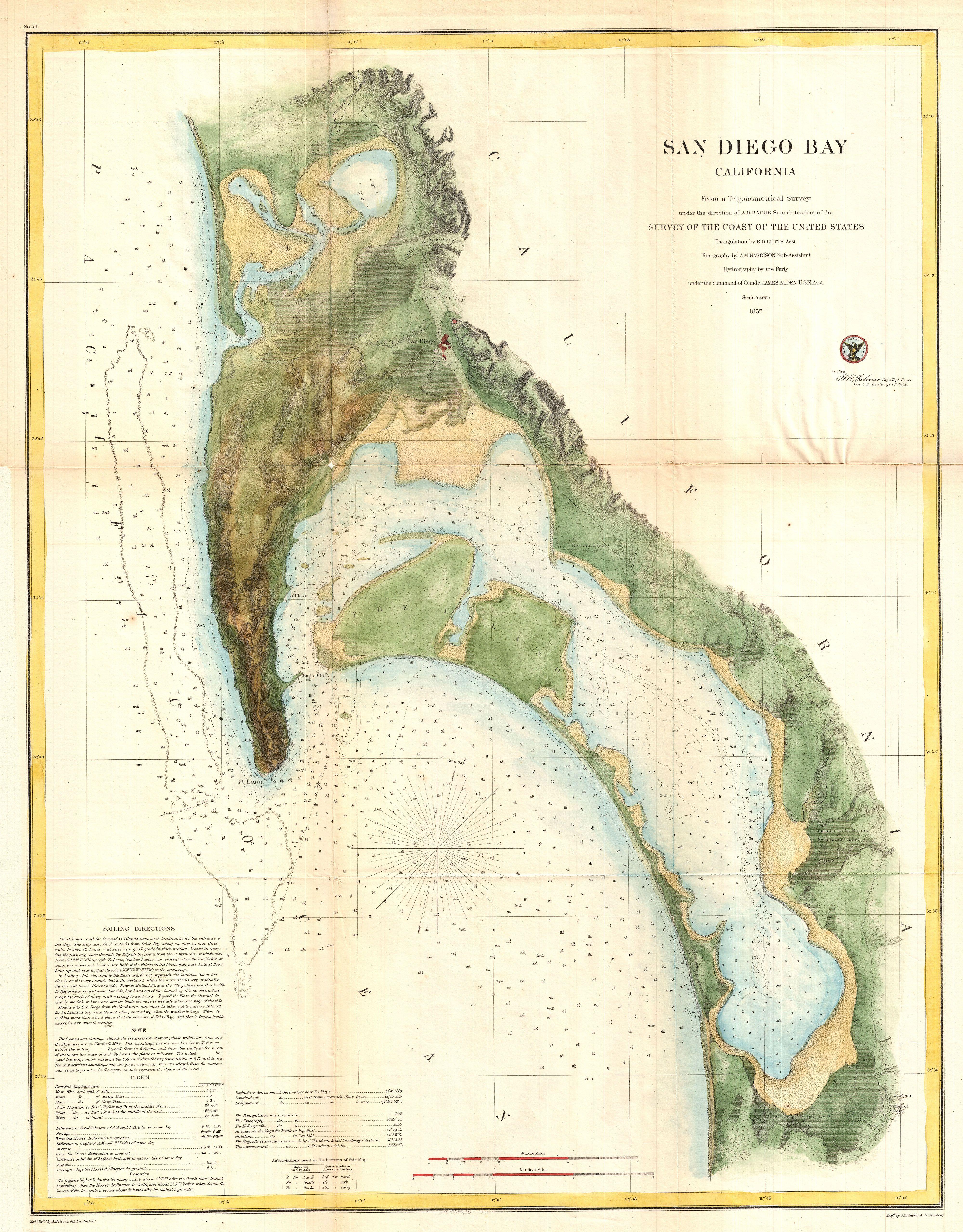
U.S.C.S. Map of San Diego Bay California Geographicus SanDiegoBayuscs. This is the most attractive map of San Diego Bay California to emerge from the work of the Coast Survey Covers the Sand Diego area from False Bay and the Valley of Las Yeguas southward past Mission Valley and San Diego city to San Diego Bay and the villages