Related Images


Download:
| Tiny | 102x128 | View | Download |
| Small | 204x256 | View | Download |
| Medium | 409x512 | View | Download |
| Large | 818x1024 | View | Download |
| Original | 3302x4131 | View | Download |
This image was acquired from
wikimedia. It was marked as Public Domain or CC0 and is free to use. To verify, go to the source and check the information there.
Looking for more info about this image?
Try a Google Reverse Image Search for it.
Try a Google Reverse Image Search for it.
Keywords from Image Description:
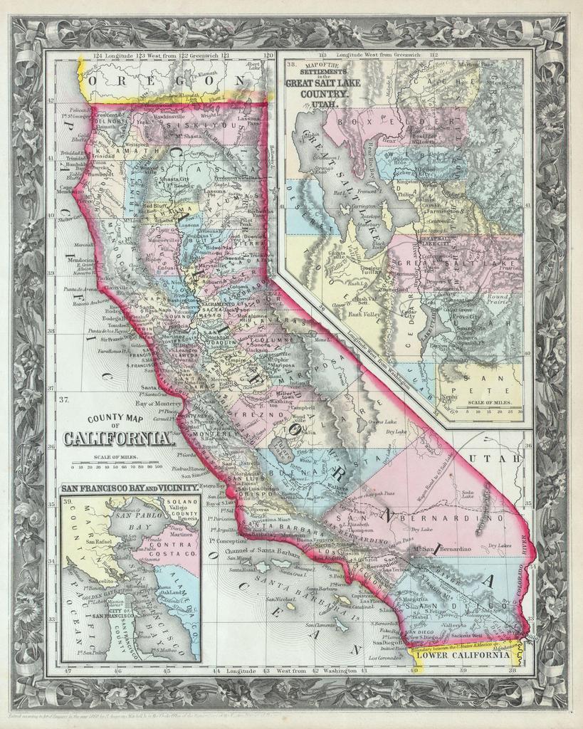
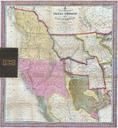
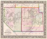
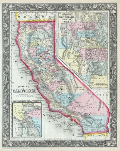
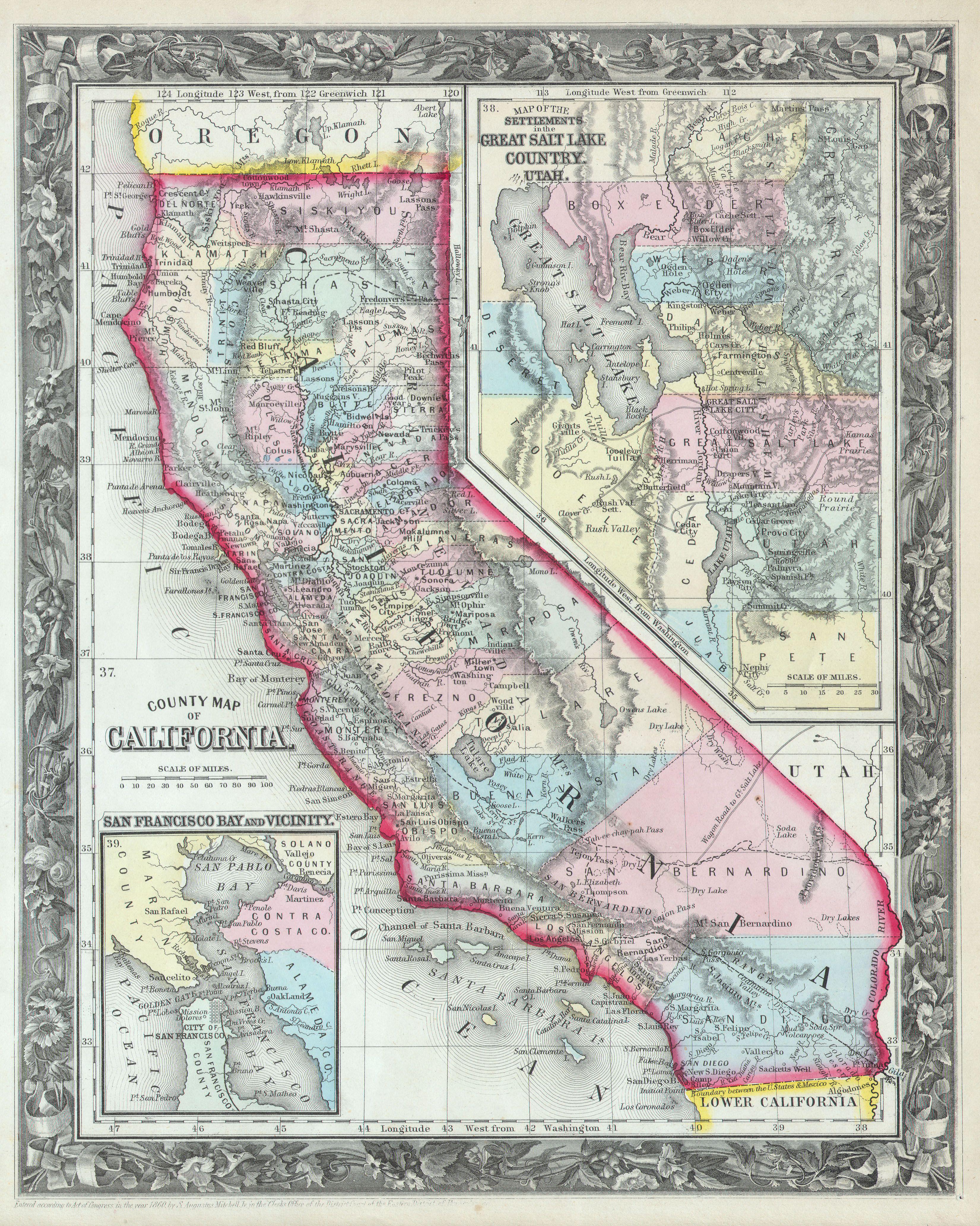
Mitchell's Map of California Geographicus CAm. This beautiful hand colored map is lithographic engraving of the states of California and Utah dating to Map divides the state into counties with notations on both political and geographical features An inset map entitled Map of the Settlements in the Great Salt Lake Country Utah