Related Images


Download:
| Tiny | 157x128 | View | Download |
| Small | 315x256 | View | Download |
| Medium | 631x512 | View | Download |
| Large | 1262x1024 | View | Download |
| Original | 3500x2838 | View | Download |
This image was acquired from
wikimedia. It was marked as Public Domain or CC0 and is free to use. To verify, go to the source and check the information there.
Looking for more info about this image?
Try a Google Reverse Image Search for it.
Try a Google Reverse Image Search for it.
Keywords from Image Description:
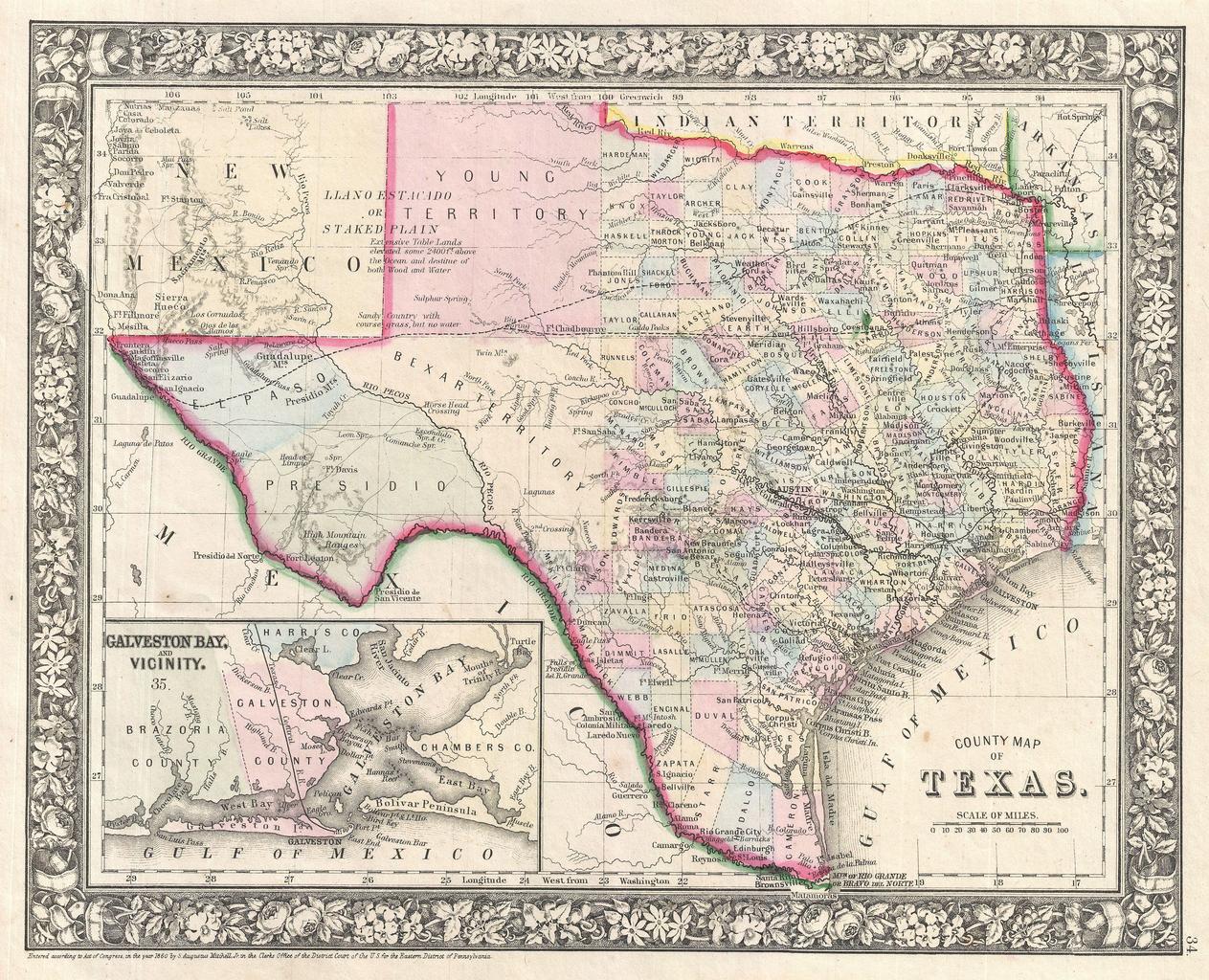
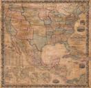
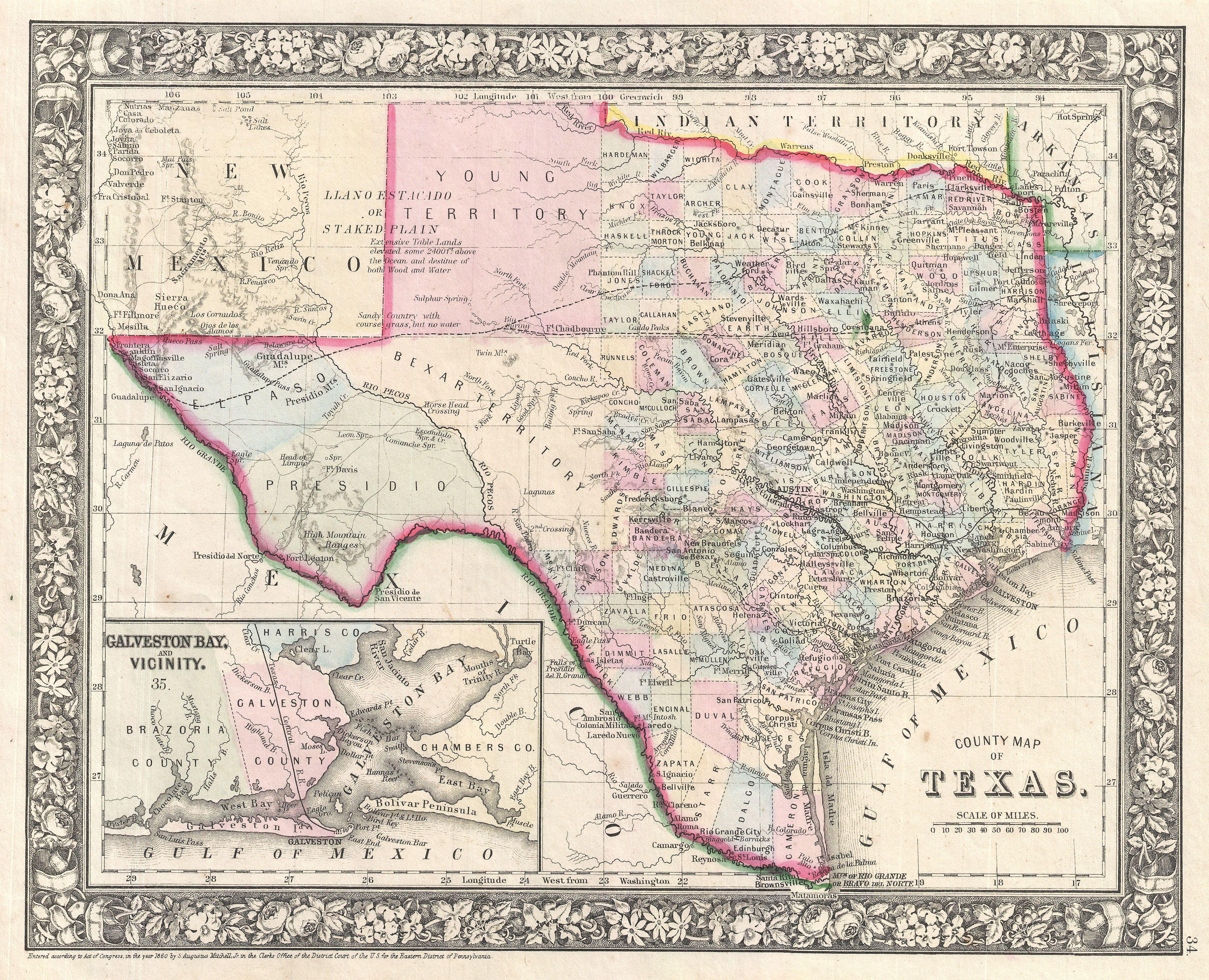
Mitchell Map of Texas Geographicus Texasmitchell. beautiful example of Mitchell Junior map of Texas and part of New Mexico Highly detailed with notations on railroads topographical features springs and cities Color coded at the county level with Bexar Young Presidio and El Paso exhibiting primitive configurations Lower left hand