
Related Images


Download:
| Tiny | 106x128 | View | Download |
| Small | 213x256 | View | Download |
| Medium | 426x512 | View | Download |
| Large | 853x1024 | View | Download |
| Original | 3878x4653 | View | Download |
This image was acquired from
wikimedia. It was marked as Public Domain or CC0 and is free to use. To verify, go to the source and check the information there.
Looking for more info about this image?
Try a Google Reverse Image Search for it.
Try a Google Reverse Image Search for it.
Keywords from Image Description:
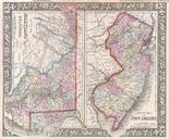
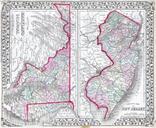
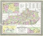
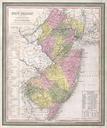
Mitchell Tanner Map of New Jersey Geographicus NewJerseymitchell. fine example of Mitchell map New Jersey highly unusual state of this map In Mitchell published two editions of the New Universal Atlas one edition with the Cary and Hart imprint and borders and another with his own Mitchell imprint and slightly different borders