
Related Images


Download:
| Tiny | 145x128 | View | Download |
| Small | 291x256 | View | Download |
| Medium | 582x512 | View | Download |
| Large | 1165x1024 | View | Download |
| Original png | 6384x5608 | View | Download |
| Original as jpg | 6384x5608 | View | Download |
This image was acquired from
wikimedia. It was marked as Public Domain or CC0 and is free to use. To verify, go to the source and check the information there.
Looking for more info about this image?
Try a Google Reverse Image Search for it.
Try a Google Reverse Image Search for it.
Keywords from Image Description:
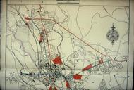
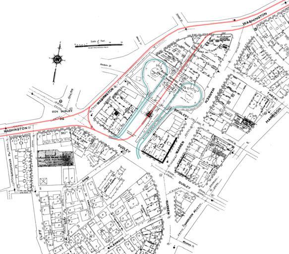
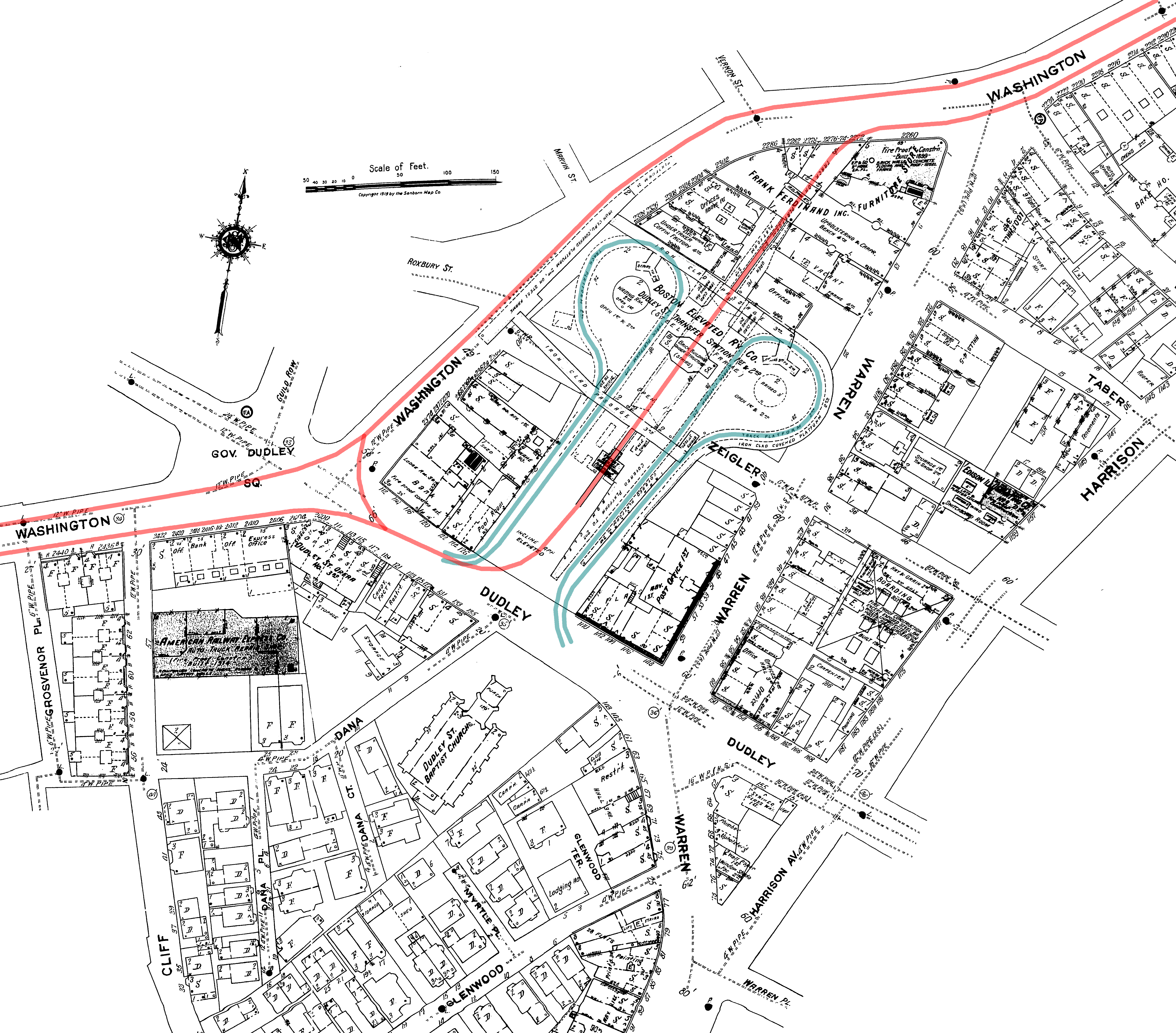
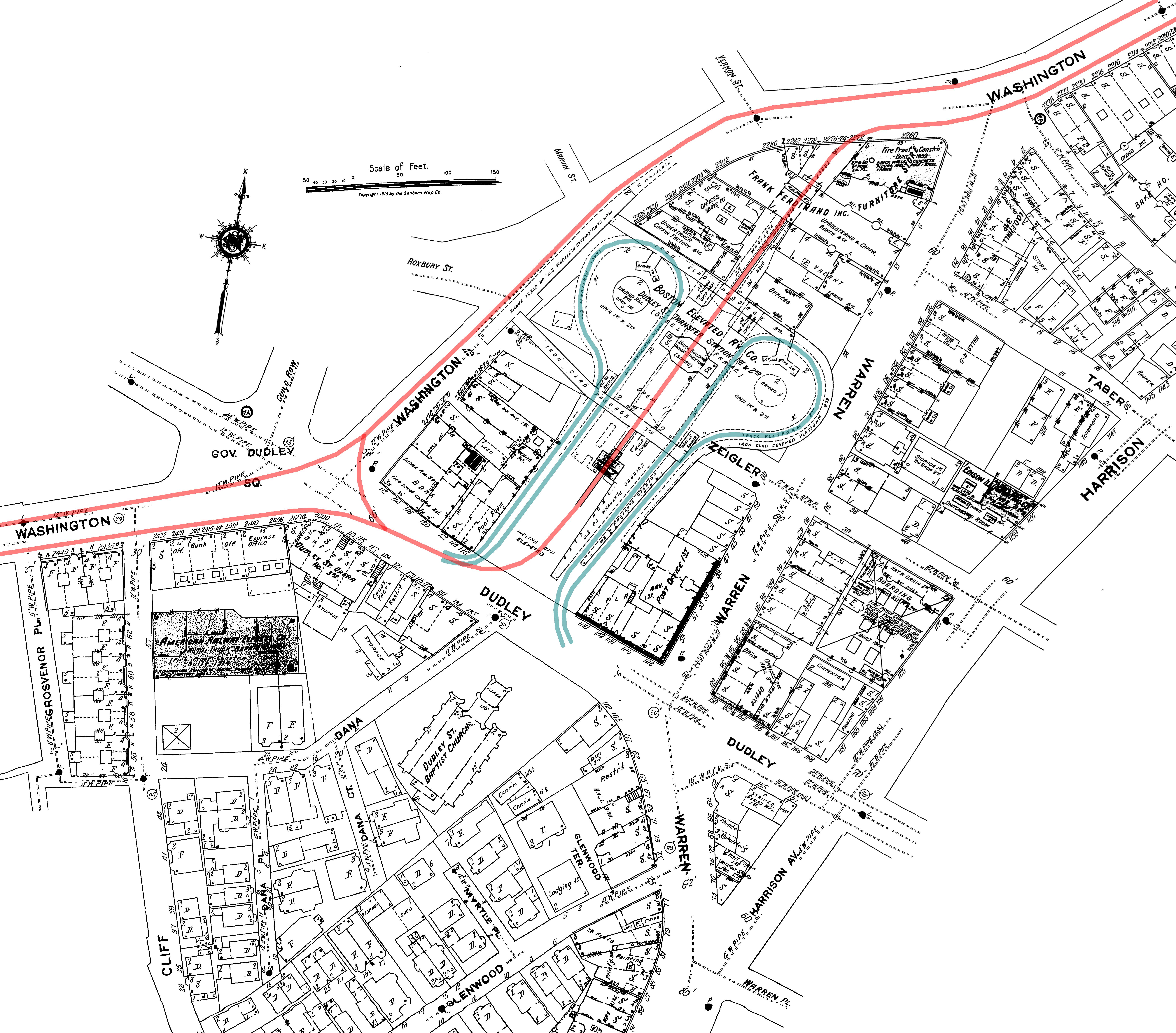
Dudley upper map. Diagram of the old Dudley elevated station in Boston accurate to the date of the base map The Main Line Elevated future Orange Line tracks are in red with the streetcar loops later busways in blue Both are on the same level with elevated walkways connecting the three platforms two on the northbound Orange Line