
Related Images


Download:
| Tiny | 157x128 | View | Download |
| Small | 314x256 | View | Download |
| Medium | 629x512 | View | Download |
| Original png | 1258x1024 | View | Download |
| Original as jpg | 1258x1024 | View | Download |
This image was acquired from
wikimedia. It was marked as Public Domain or CC0 and is free to use. To verify, go to the source and check the information there.
Looking for more info about this image?
Try a Google Reverse Image Search for it.
Try a Google Reverse Image Search for it.
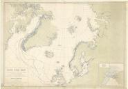
Keywords from Image Description:
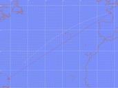
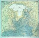
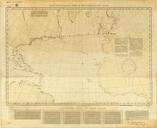
Great Circle Sailing Chart of the North Atlantic Ocean. en Great Circle Sailing Chart of the North Atlantic Ocean created in by the United States Hydrographic Office Annotated by Charles Lindbergh wdl org United States Hydrographic Office PDUSGov Uploaded with Charles Lindbergh maps Maps of the North Atlantic Great circle