
Related Images


Download:
| Tiny | 184x128 | View | Download |
| Small | 369x256 | View | Download |
| Medium | 738x512 | View | Download |
| Large | 1476x1024 | View | Download |
| Original tiff | 6300x4368 | View | Download |
| Original as jpg | 6300x4368 | View | Download |
This image was acquired from
wikimedia. It was marked as Public Domain or CC0 and is free to use. To verify, go to the source and check the information there.
Looking for more info about this image?
Try a Google Reverse Image Search for it.
Try a Google Reverse Image Search for it.
Keywords from Image Description:
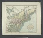
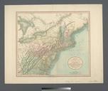
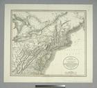
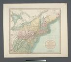
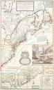
Map of Virginia and Maryland constructed from the latest authorities NYPL b. en Includes statistical tables of population according to the census of Population data for towns and counties pasted on verso of front cover Inset Plan of Washington City Georgetown National Endowment for the Humanities Grant for Access to Early Maps of