Related Images


Download:
| Tiny | 170x128 | View | Download |
| Small | 341x256 | View | Download |
| Medium | 682x512 | View | Download |
| Original | 798x599 | View | Download |
This image was acquired from
wikimedia. It was marked as Public Domain or CC0 and is free to use. To verify, go to the source and check the information there.
Looking for more info about this image?
Try a Google Reverse Image Search for it.
Try a Google Reverse Image Search for it.
Keywords from Image Description:
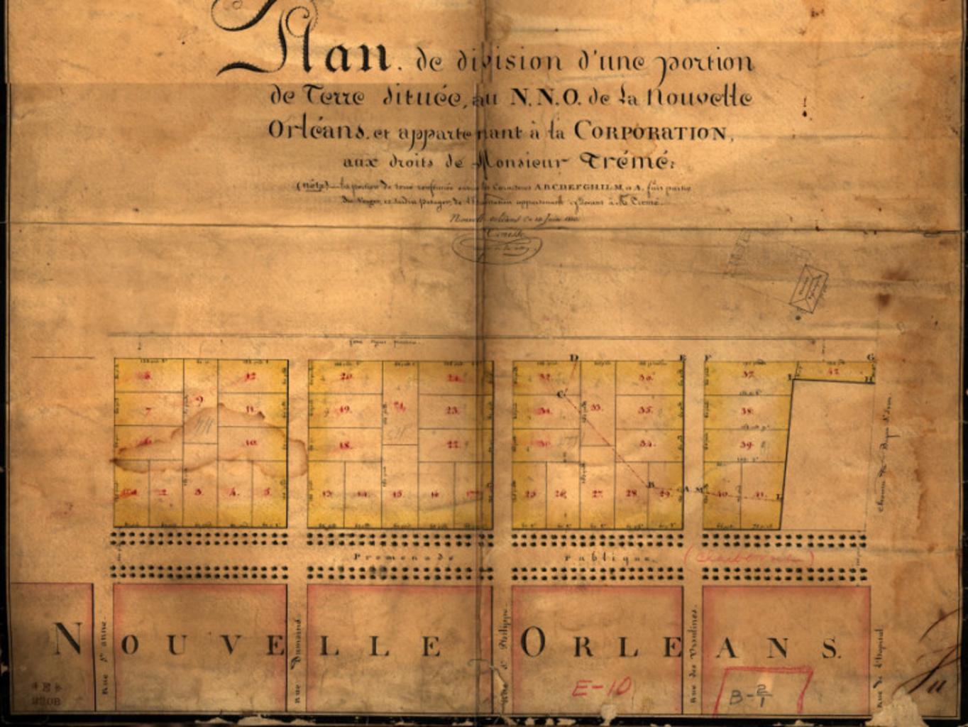
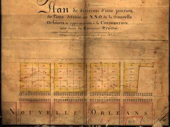
Plan Treme New Orleans . Plan de division d'une portion de terre situee au de la Nouvelle Orleans et appartenant la Corporation aux droits de Monsieur Treme map of section of New Orleans with wide Rampart Street horizontally at lower center showing earlier development of Faubourg Treme neighborhood St Anne Street is the vertical