
Related Images


Download:
| Tiny | 254x128 | View | Download |
| Small | 509x256 | View | Download |
| Medium | 1018x512 | View | Download |
| Large | 2037x1024 | View | Download |
| Original | 5000x2513 | View | Download |
This image was acquired from
wikimedia. It was marked as Public Domain or CC0 and is free to use. To verify, go to the source and check the information there.
Looking for more info about this image?
Try a Google Reverse Image Search for it.
Try a Google Reverse Image Search for it.
Keywords from Image Description:
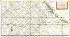
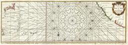
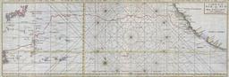
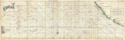
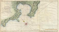
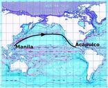
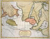
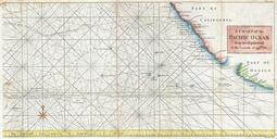
Anson Map of Baja California and the Pacific wxF Trade Routes from Acapulco to Manila Geographicus Pacificanson. This is rare nautical chart of the Pacific Ocean by George Anson and Seale Chart depicts the trade routes used by Spanish Galleons from Acapulco Mexico heading towards Manila in the Philippines In particular this chart


