Related Images


Download:
| Tiny | 149x128 | View | Download |
| Small | 298x256 | View | Download |
| Medium | 596x512 | View | Download |
| Large | 1192x1024 | View | Download |
| Original | 3500x3006 | View | Download |
This image was acquired from
wikimedia. It was marked as Public Domain or CC0 and is free to use. To verify, go to the source and check the information there.
Looking for more info about this image?
Try a Google Reverse Image Search for it.
Try a Google Reverse Image Search for it.
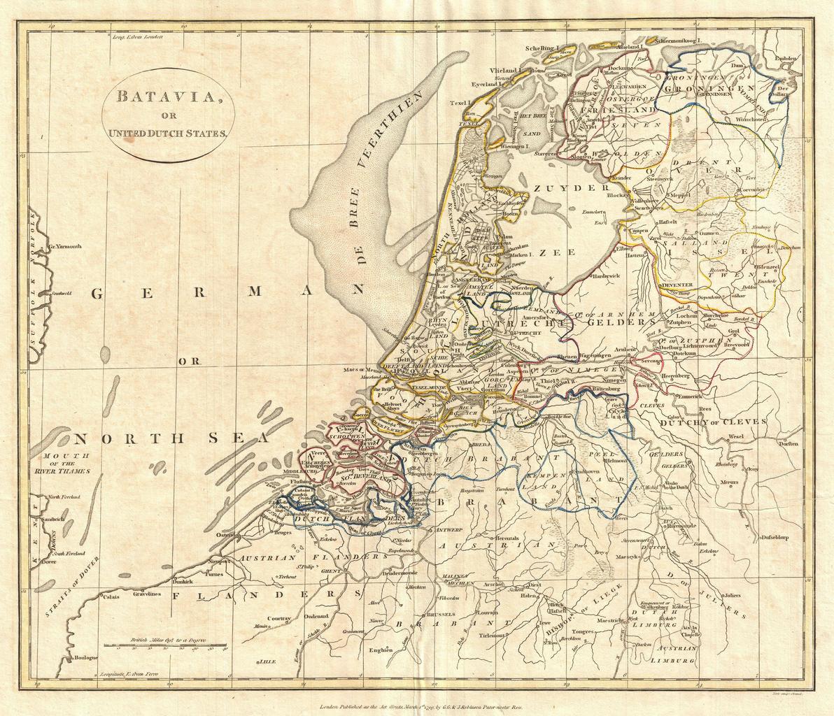
Keywords from Image Description:
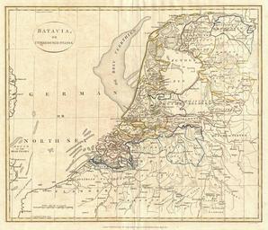
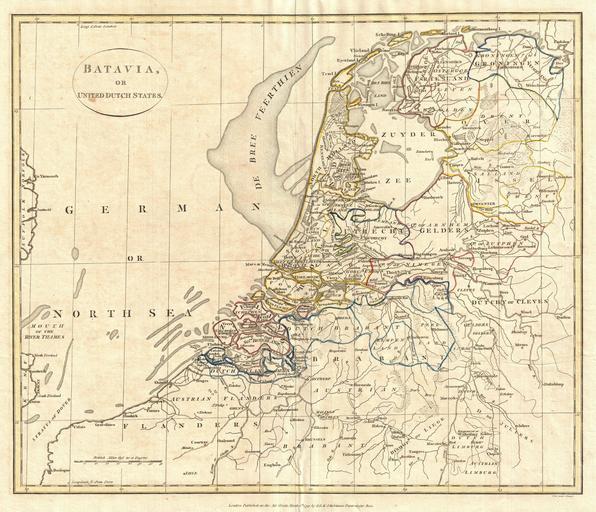
Clement Cruttwell Map of Holland or the Netherlands Geographicus Bataviacruttwell. fine map of Batavia or the United Dutch States the Netherlands by the English map publisher Clement Cruttwell Map is highly detailed with counties and municipalities outlined Of note on this particular map are the canals and dikes Cruttwell labeled