Related Images


Download:
| Tiny | 150x128 | View | Download |
| Small | 301x256 | View | Download |
| Medium | 602x512 | View | Download |
| Large | 1204x1024 | View | Download |
| Original | 4931x4192 | View | Download |
This image was acquired from
wikimedia. It was marked as Public Domain or CC0 and is free to use. To verify, go to the source and check the information there.
Looking for more info about this image?
Try a Google Reverse Image Search for it.
Try a Google Reverse Image Search for it.
Keywords from Image Description:
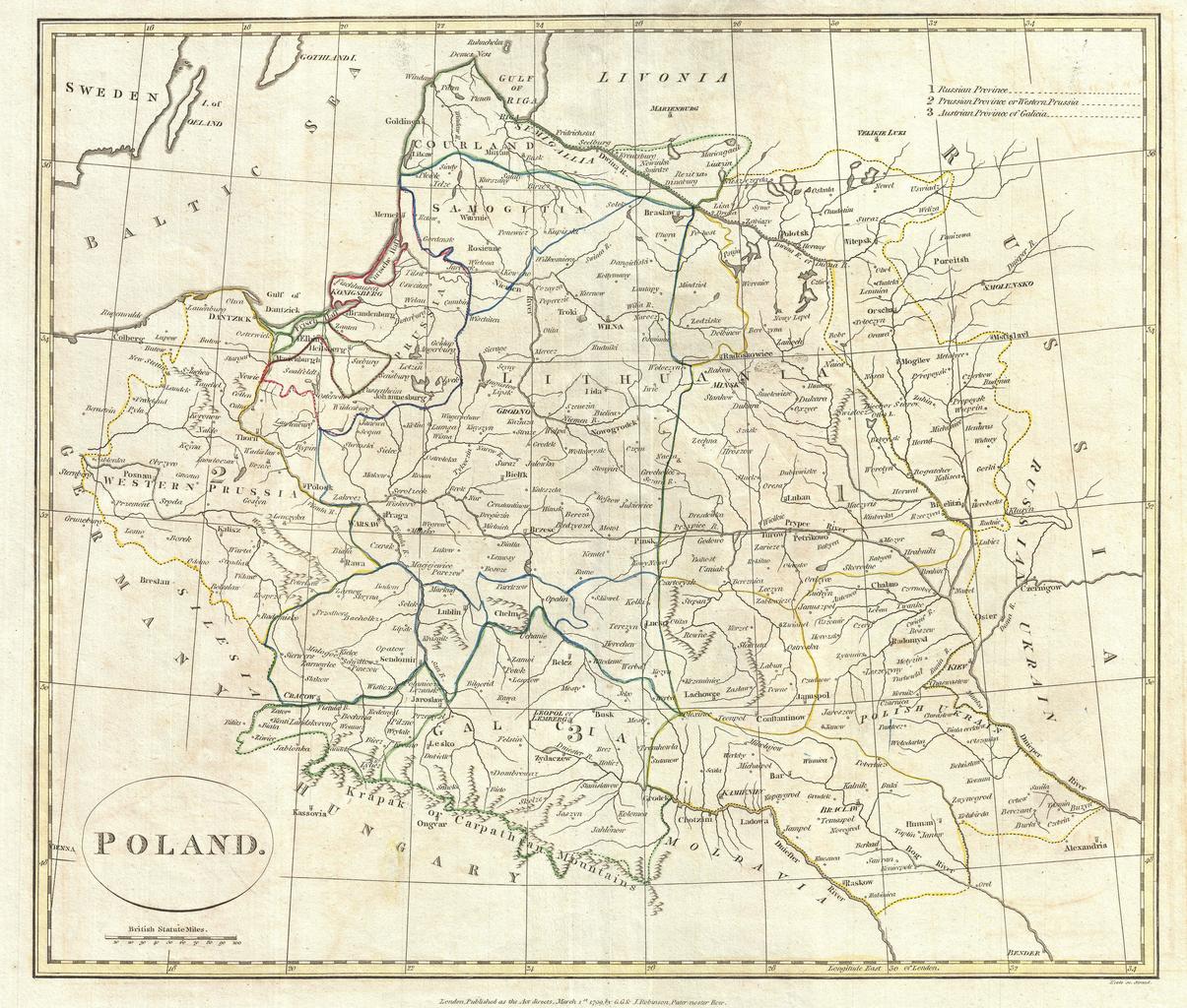
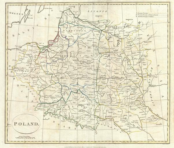
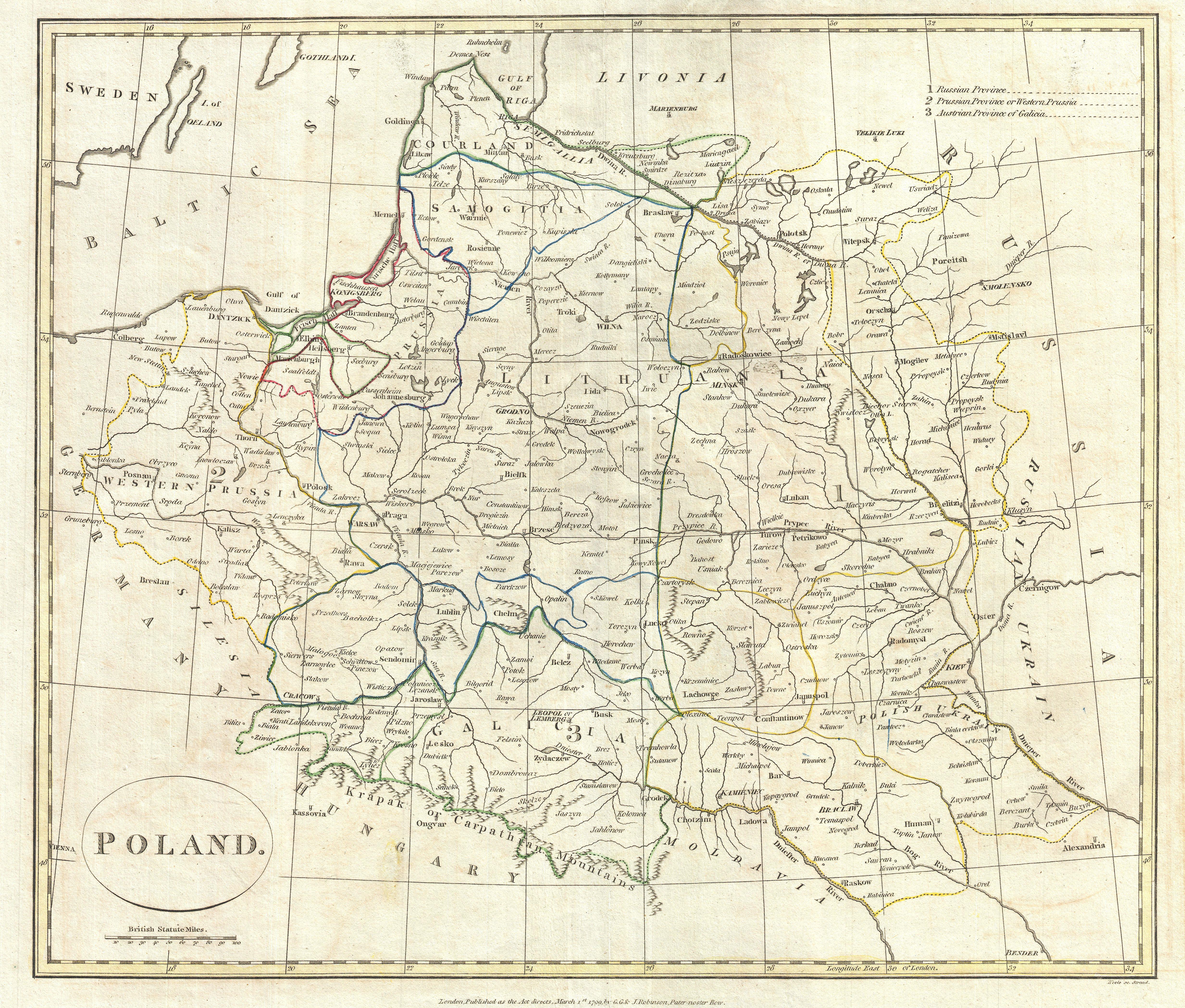
Clement Cruttwell Map of Poland and Lithuania Geographicus Polandcruttwell. fine map of Poland by the English mapmaker Clement Cruttwell Shows the partitioning of the PolishLithuanian Commonwealth in between Prussia Austria and Russia The map covers the area from Poznan in the west to just west of Kiev in the east and from as


