
Related Images

Download:
| Tiny | 151x128 | View | Download |
| Small | 303x256 | View | Download |
| Medium | 606x512 | View | Download |
| Large | 1212x1024 | View | Download |
| Original | 5000x4224 | View | Download |
This image was acquired from
wikimedia. It was marked as Public Domain or CC0 and is free to use. To verify, go to the source and check the information there.
Looking for more info about this image?
Try a Google Reverse Image Search for it.
Try a Google Reverse Image Search for it.
Keywords from Image Description:
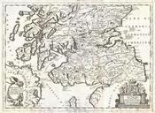
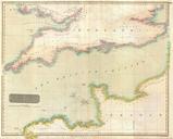
Thomson Map of Southern Scotland Geographicus ScotlandSoutht. This hand colored map is steel plate engraving dating to by the important English map publisher John Thomson It depicts the southern portion of Scotland from the Island of Mull to the border with England In the lower left hand corner of the map there is view of Port