Related Images


Download:
| Tiny | 174x128 | View | Download |
| Small | 348x256 | View | Download |
| Medium | 697x512 | View | Download |
| Large | 1395x1024 | View | Download |
| Original | 5000x3670 | View | Download |
This image was acquired from
wikimedia. It was marked as Public Domain or CC0 and is free to use. To verify, go to the source and check the information there.
Looking for more info about this image?
Try a Google Reverse Image Search for it.
Try a Google Reverse Image Search for it.
Keywords from Image Description:
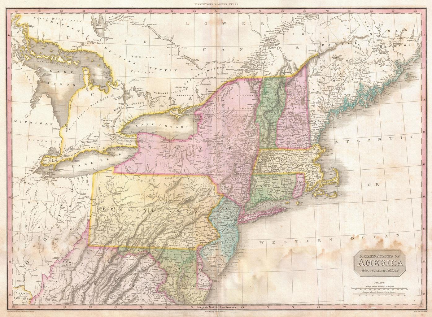
Pinkerton Map of the Northern United States Geographicus USANorthernPartpinkerton. John Pinkerton's highly decorative and important map of the northern parts of the United States published Covers from Lake Huron eastward as far as New Brunswick and southwards as far as the Chesapeake Bay Includes the states of New York New Jersey