
Related Images


Download:
| Tiny | 104x128 | View | Download |
| Small | 209x256 | View | Download |
| Medium | 418x512 | View | Download |
| Large | 837x1024 | View | Download |
| Original | 2045x2500 | View | Download |
This image was acquired from
wikimedia. It was marked as Public Domain or CC0 and is free to use. To verify, go to the source and check the information there.
Looking for more info about this image?
Try a Google Reverse Image Search for it.
Try a Google Reverse Image Search for it.
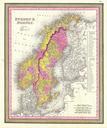
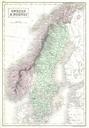
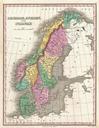
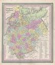
Keywords from Image Description:
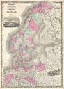
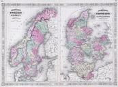
Mitchell Map of Scandinavia Norway Sweden Denmark Finland Geographicus NorwaySwedenmitchell. beautiful example of Mitchell senior's map of Scandinavia including Sweden Norway Denmark and Finland Map shows Scandinavia in full with color coding according to region table to the right of the map details various districts and prefectures