
Related Images


Download:
| Tiny | 296x128 | View | Download |
| Small | 592x256 | View | Download |
| Medium | 1185x512 | View | Download |
| Large | 2370x1024 | View | Download |
| Original | 5000x2160 | View | Download |
This image was acquired from
wikimedia. It was marked as Public Domain or CC0 and is free to use. To verify, go to the source and check the information there.
Looking for more info about this image?
Try a Google Reverse Image Search for it.
Try a Google Reverse Image Search for it.
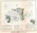
Keywords from Image Description:
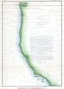
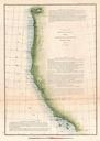
U.S. Coast Survey Map of the Western Florida Panhandle Geographicus FloridaPensauscs. This is an attractive Coast Survey triangulation chart of the coast of Florida Covers from Perdido Bay eastward past Pensacola Bay and Santa Rosa Bay so St Marks and Appalachie Bay Shows the city of Pensacola Florida Produced under the direction